Limantour Beach Afternoon
Two weekends after our Rae Lakes excursion and no hiking, DD definitely wanted to head out for a trek. His goal was to do a 16-17 mile training hike and he found us a route in Point Reyes. He mentioned it would be good practice for the West Coast Trail, as we’d do some beach walking. I was a little apprehensive about the distance, and worried about leaving Harlow alone for such a long time (I estimated we’d take 6-8 hours, at least).
We woke late (DD later admitted that he had stayed up until 1am finishing The Martian), and didn’t get to leave the house until 9:30am or so. In addition, I woke that day with a pain in the arch of my right foot. On top of everything else, the heat and warmth projected for the day also worried me, so I was a little grumpy out of the gate. DD ate some prepackaged dehydrated jook for breakfast. It turned out pretty good, augmented with dried fried shallots and pork floss. I had a few bites and consumed a ProBar Base Cookie Dough protein bar. Not the best-tasting thing, but also not too terrible. I managed to force it down gradually, as I was getting ready for the day.
Despite the lateness, we stopped at Fairfax Coffee Roastery for some additional food. I was hungry again and had a slice of spinach and mushroom frittata. DD ate a Whoopie Cookie and we both procured a couple of sandwiches for lunch later that day.

Point Reyes Hiking Map South District
Finally, we reached Limantour Beach parking lot. It was around 11:30, and we were surprised to find the parking lot still fairly empty on a beautiful Saturday morning. We used the vault toilet and got on our way. Our planned route would take us for a walk along the beach, and then we’d head up east to Coast Trail (near Coast Camp) towards Sculptured Beach and Arch Rock, visit around Glen Camp, and then head north on Baldy/ Sky Trails before heading west and returning to the beach again via Woodward Valley Trail and Limantour. 16.9 miles or so. We each carried around 22 lbs in our pack. My weight included 4 litres of water. 22 lbs vs 30 lbs makes an incredible difference – I felt as light as air!
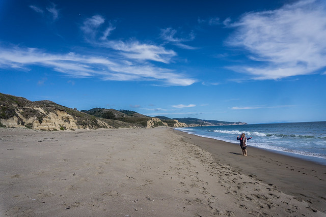
Solitude on the beach
DD kept reminding me that beach hiking practice was good for us. It comprised much of the Lost Coast Trail, and would likely be a large portion of the West Coast Trail. My foot was not happy, but hiking was bearable despite the soft sand and I’d only occasionally encounter some shooting, sharp pains. It was slow going, but beautiful, and we practically had the beach to ourselves. Though it was slightly overcast, it was also fairly warm. I was grateful to have occasional sea breezes to cool us.

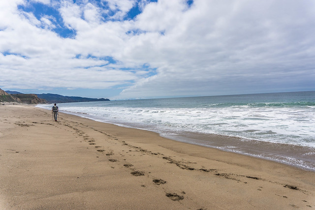
Sculptured Beach
We kept walking on the beach until it looked like we would not be able to pass any longer. A brief exploration by Danny revealed that we had perhaps stumbled upon a section of Sculptured Beach, which had many beautiful formations.
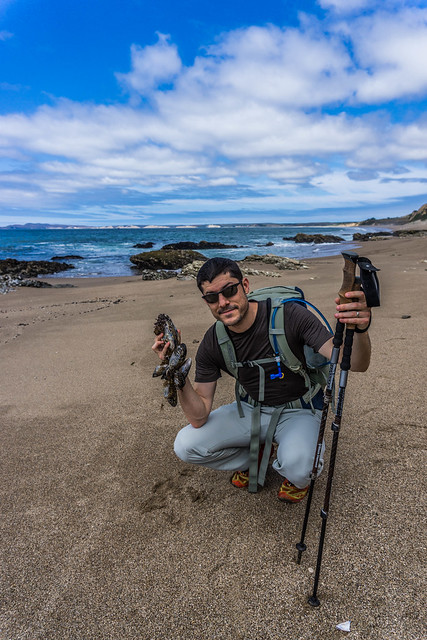
Mussels!
We found lots of mussels on the beach, and regretted that we didn’t have the time to harvest or otherwise do something with them. Some were enormous!
“It’s dripping poison oak from above!”
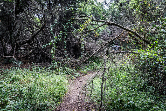
After Sculptured Beach and checking the map, DD determined that we had missed the turnoff to get to the Coast Trail. We ventured up what looked like a little-used staircase that was steep and a bit rickety. When we reached the top, there was another bit of overgrown trail that showed energetic and enthusiastic poison oak growth. At one point, DD exclaimed to watch out above, as there were branches of poison oak reaching over the trail itself, at head level.
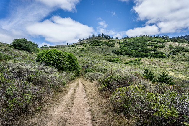
Coast Trail heading into the forests
We survived and finally made it out to the Coastal Trail, which was more exposed, but still featured warning clusters of poison oak here and there. After about 5 miles in, and after realizing that we were making fairly slow progress at about 20-25 minutes per mile, DD decided to cut out route short. That was a relief. We’d go for around 12-13 miles instead of 17, which would hopefully get us back to the car by 5pm.
The Sky Trail goes up and up and up, from around 100 feet in elevation to around 1000 feet in 2 miles. The trail was exposed at times, and shaded at times. Poison oak continued to thrive along the trailsides. We began to see more forested areas, though, and smell the sweet scents of bay.
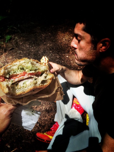
Eating our sandwiches
We paused for lunch and to eat our sandwiches from earlier. There didn’t seem to be any great place for us to pull off the trail for this, so, we just plopped down in a section that looked somewhat wider than prior segments, and threw down our packs. I was not completely hungry, but I ate anyway. I was starting to learn that waiting until hungry to eat was probably not the best idea while on the trail. The sandwiches from Fairfax Coffee Roastery were great – but even better augmented by a bit of olive oil DD had brought.
When we finally hit the intersection of Sky Trail with Woodward Valley trail, we rightly suspected that the rest of our hike would be downhill. Of course, downhill was once again harder with my hurting right foot than uphill, but the pain was bearable.
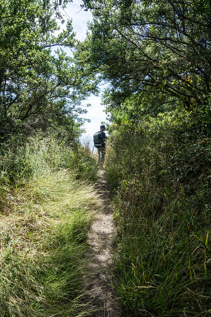
Overgrown trails
We were glad for wearing long pants due to a good part of the what we traversed being quite overgrown with grasses and who knows what else. We knew that we would want to wash up with Tecnu when we got home.
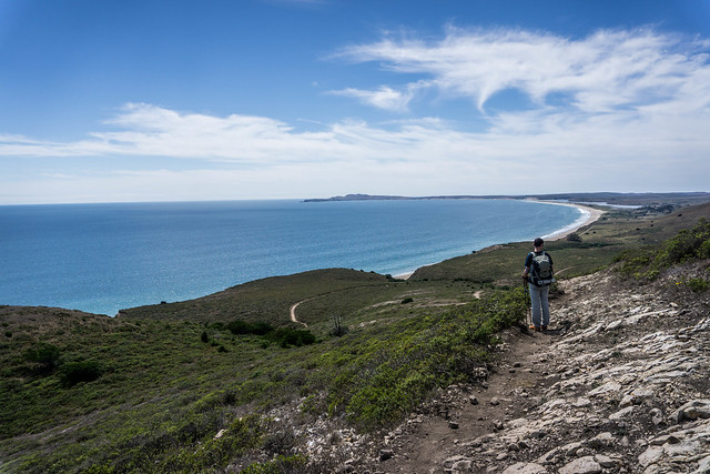
On the descent towards the sea
We finally emerged from the forest and came out onto the Coastal Trail again. We once more had gorgeous views of the ocean to accompany us on our hike back to the car.
Other random thoughts
- Limantour Beach is dog-friendly
- We need to explore the tidepools more
- We need to make it out to Arch Rock
- If planning a 17-mile hike, better to get an earlier start
- LOTS of poison oak everywhere
- Would like to camp here, at some point. Perhaps we need to try Glen Camp or Wildcat; Coast Camp is frequented by families and does not appear to have shade trees, but it’s very close to the beach. Wish the camps allowed pets.
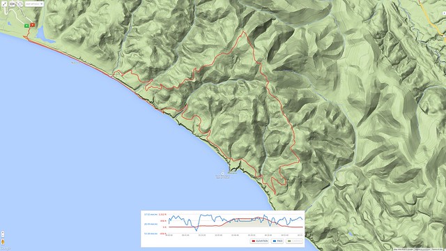
Route as tracked by my Garmin 920XT, viewable on MapMyRun.com
More photos/ links
- See more of my photos on Flickr here.
- See Danny’s photos here.
- Point Reyes Hiking Trails map, South district.