Wednesday, 29 July 2015. Darling River to Tsuquadra Point
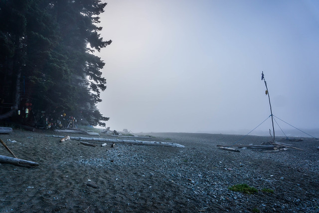
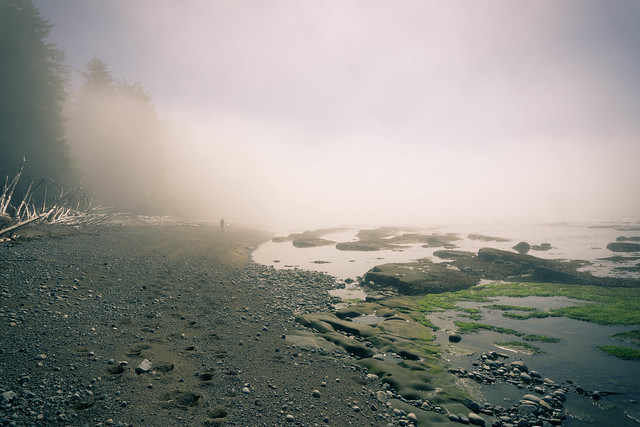
We woke to fog coming off the sea. We took our time that morning, drinking coffee, making breakfast – this morning it was cheesy grits and ham – a perfect savoury meal made with Bob’s Red Mill Grits, simple dehyrdrated deli ham, and some generous tablespoonfuls of dehydrated milk and cheese. DD especially wanted to explore the tidepools exposed by low tide. I did not go out as far, fearing that my $2 Japanese rubber slippers, rubber nothwithstanding, might not be a match for the slippery, wet rocks strewn with seaweed.
But the landscape was gorgeous and otherwordly…
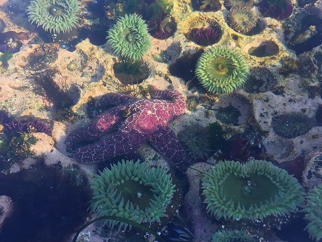
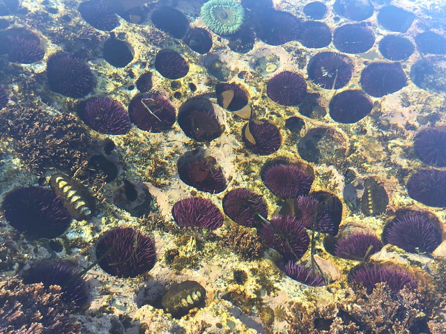
We saw numerous crabs scuttling about, sea anemones, and endless seaweed growth, clinging to the sandstone. DD found some amazing anemones and purple sea urchins, nestled so comfortably in their rock hidey-holes.
We started out around 10:40am, hiked along the beach for a while, and headed inland at the next campsite at Tsocowis Creek. Along the way, we’d hail groups of hikers heading in the opposite direction and asked where they came from. We also met two groups of folks who inquired us whether we had seen the bear near our campsite where it had been ambling a few minutes prior. Unfortunately, like at Rae Lakes, we had not.
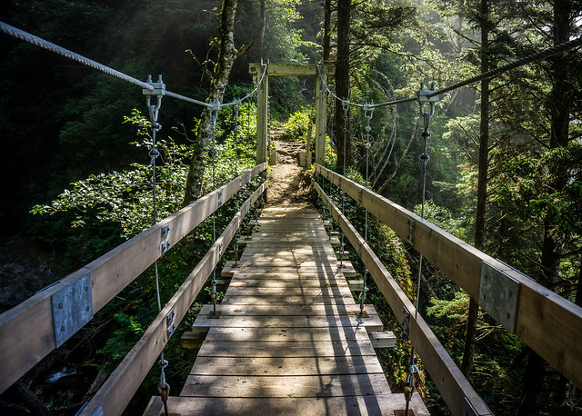
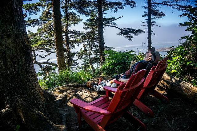
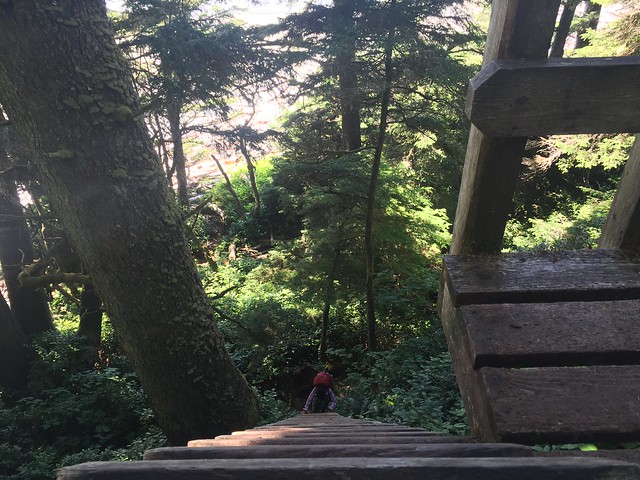
Hiking inland, we encountered a bridge that had the very best views on the entire trail.
There was another bridge on Day 3 that would have been a contender, had I not suddenly realized that I was in danger of losing my hiking poles!
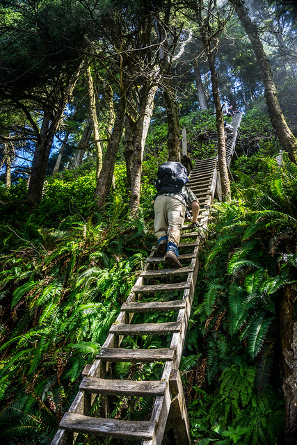
We also began to encounter longer and longer ladders.
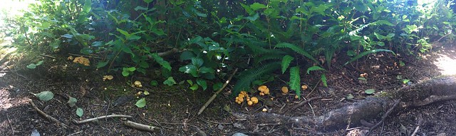
And DD of course found some more chanterelle mushrooms!
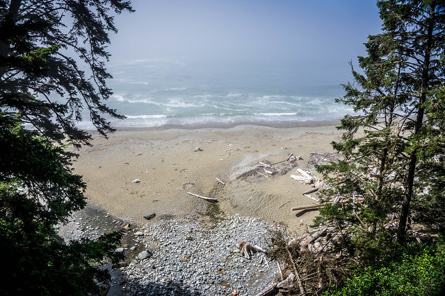
Sometimes there was a fantastic lookout point that would have been awesome for lunch, had we stopped to have lunch… most of the time on this day we snacked on candy bars, Gu, and Honey Stinger Waffles while trekking.
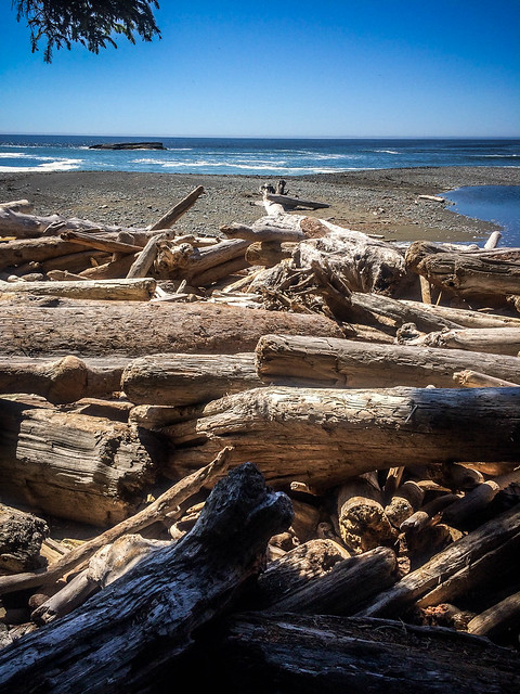
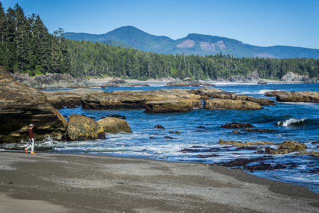
Heading back out on the beach, there were sometimes obstacles to be climbed.
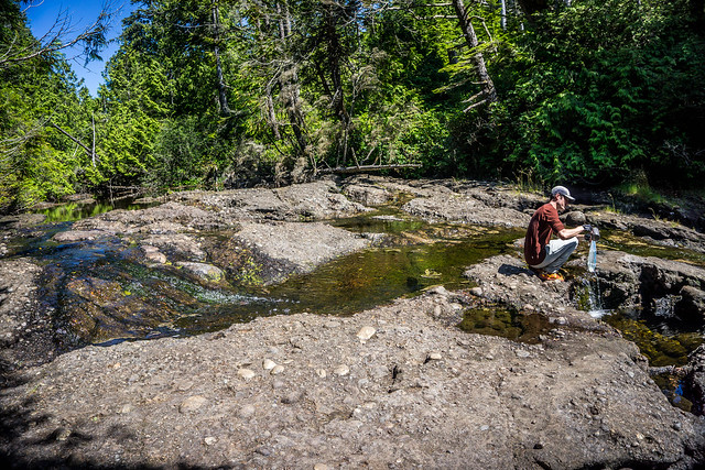
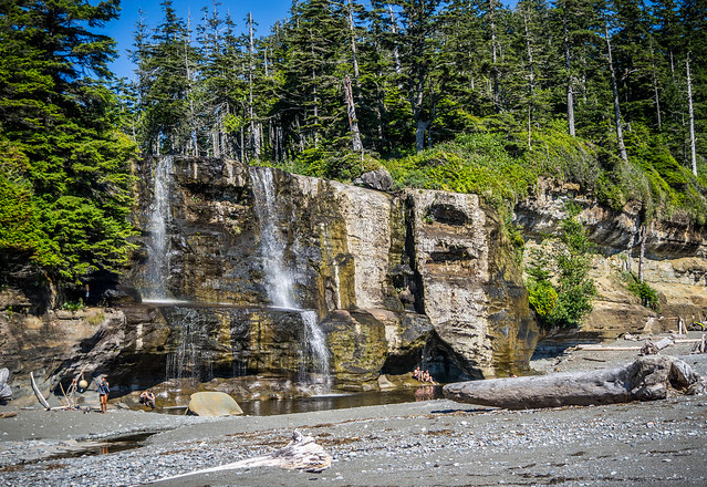
We had initially planned on just hitting Tsusiat Falls on this day, and so when we reached the top of the falls, DD quickly made sure we filtered water first. Even then, the water didn’t look too great. We had certainly been spoiled by the clear, cold fabulousness of the water in the Sierras.
As we descended another ladder to the beach/ camping area and wandered around, it was around 3pm. We quickly realized that while the falls did seem nice, the campgrounds, which were already filled at this fairly early hour, were exposed to the hot sun – there was very little shade. DD went off in search of the composting toilet and declared that we would pause here a while, have some lunch, and determine whether we should move on, or stay.
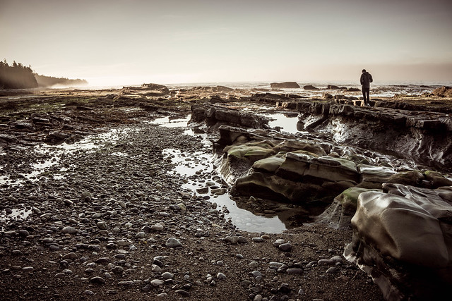
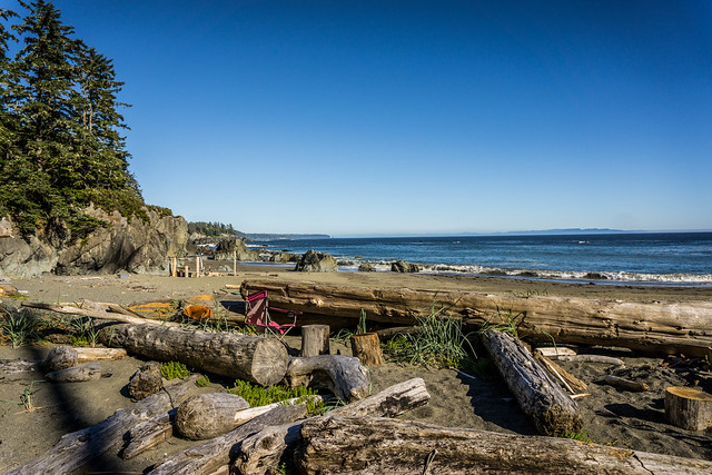
We eventually decided we would move on, and take our chances with the designated camping site on Indian Reservation land, marked on our map at Tsuquadra Point. This meant trekking about 4km more on the beach, which can be either fairly easy and pleasant if the sand is hard-packed enough, but a slog if not. Like our other beach walking, it was a mixture of both.
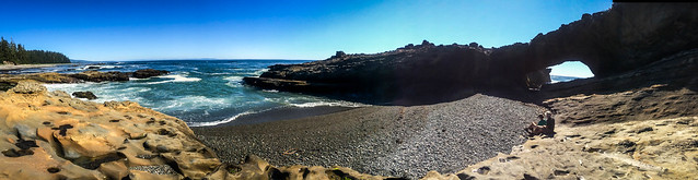
We saw very beautiful Tsusiat Point, or “Hole Point,” where several folks were resting or clambering atop the rocks and taking photos. It was hard to get a photo in without folks in the background.
We missed the inland beach access marker to Tsuquadra initially, and had to backtrack for a bit. Beach hiking is really so much prettier than inland trekking, though, but it’s easy to miss some signals, especially if you’re hell-bent on making good time along the hard-pack nearer the water. Along the way, DD had begun querrying several north-bound hikers about the Indian Reservation campsite. We learned that there were luxury tent cabins for $90, but that we might be allowed to camp on their beach for just $10. We hoped the latter was indeed true. We began to fantasize about running water and showers; we had been warned that fresh water might be a little scarce after Tsusiat Falls.
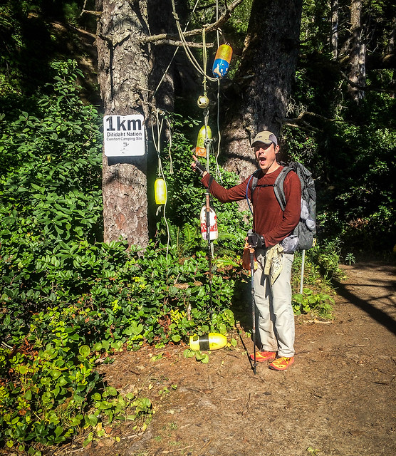
Finally! Only 1km more to camp!
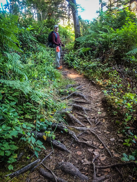
The inland path to the Ditidaht Nation campsite, though, was rooty and difficult. We were definitely going to earn our camping that night!
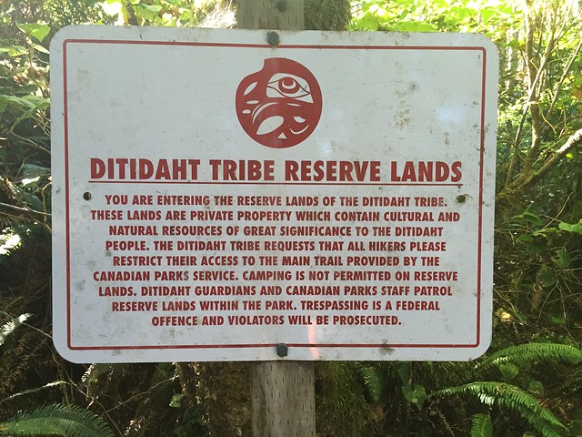
And yes, as we approached, our hosts, whose names we later learned were Stephen and Julian, hailed us to let us know that the ferry at Nitinat was likely going to be stopping operations at 5pm. No problem, since we had not intended to continue to Nitinat that evening. We asked them about the $10 beach camping, to which they agreed.
And so, when we finally stopped at 6pm (having hiked for over 8 hours) we ended up having the entire beach to ourselves. My notes for the day say that although we had gone “only” about 16km, or 9-10 miles, it had felt like a very long day. Our paths were occasionally smooth but more often was difficult and technical, with muddy roots to be navigated. More ladders, bridges and boardwalks, the latter being a mix of new and old/ rotten. The ups and downs on ladders were challenging.
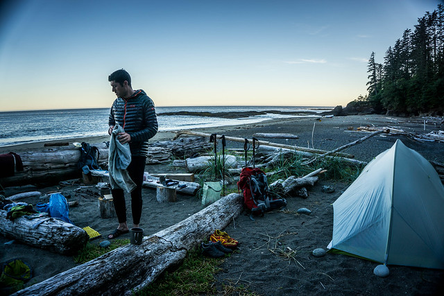
There was a creek with water both at the edge of camp and a small stream at the beach. No showers or other running water, but we were happy nonetheless. We hastily made camp and dinner and managed to do some laundry.
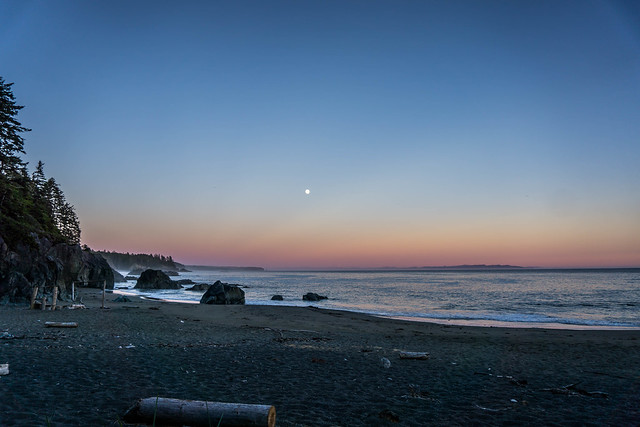
And enjoyed another beautiful sunset with full moon rising on the beach…
West Coast Trail Posts
- WCT Trip Planning
- WCT Day Zero + Flickr Photos
- WCT Day One + Flickr Photos
- WCT Day Two + Flickr Photos
- WCT Day Three + Flickr Photos
- WCT Day Four + Flickr Photos
- WCT Day Five + Flickr Photos
Pingback: West Coast Trail Day One | Legs, Engage!()
Pingback: West Coast Trail 2015 Day Zero | Legs, Engage!()
Pingback: West Coast Trail Day Three | Legs, Engage!()
Pingback: West Coast Trail Day Four | Legs, Engage!()
Pingback: West Coast Trail Trip Planning | Legs, Engage!()