Eighteen Miles. Eighteen Miles! I should have figured it out on my own, when DD said that we’d be thru-hiking 28 miles, and completing only 10 in the first day. But I was stunned and demoralized on Day 1 and couldn’t comprehend another day that was longer and possibly as difficult as the first. I’ve run 18 miles in the past, but on relatively flat terrain or in San Francisco where hills were not as prolonged or steep, and certainly not while carrying a full 20+ pound backpack.
DD assured me that today’s route would be easier, that the inclines were not as steep, and there might be points on the trail (such as the Sunol Visitor Center, 10 miles in) where we could cut it short, if we really were exhausted. That cheered me up a bit.
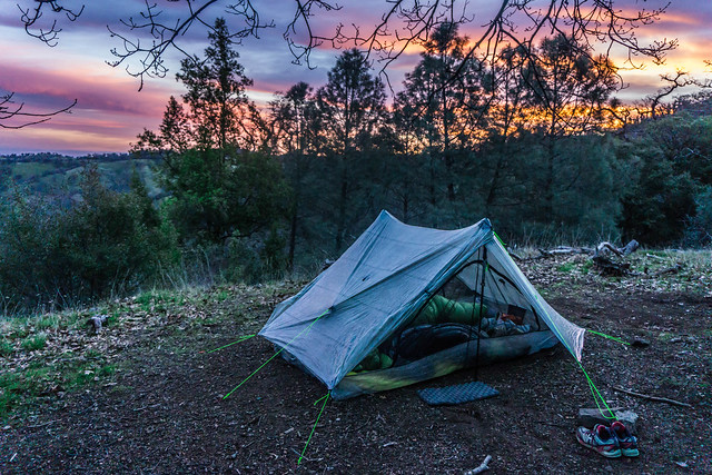
I rose with the birds. Sleep had been a little fitful that night. I felt the cold pressing on my face and neck, and though the rest of my body was pretty comfortable in my Zpacks 30-degree sleeping bag/ quilt, I hadn’t known that I could tighten the cord around my upper body, as DD showed me later. That’s what these training hikes are for, I suppose, to learn about the ins and outs and other gear limitations.
During the night I had woken on numerous occasions (when the frogs stopped croaking, or when they started up again, for instance), as did DD, but perhaps because we were resting for nearly 12 hours, we felt perky and refreshed, especially after our morning caffeine. And, for the record, the Mountain House Breakfast Skillet (eggs, hashed browns, sausage and some veggie bits) is very tasty. DD and I shared a 2-serving pack, where 1 serving = 400 calories. Thumbs-up.
Day 2 – Maggie’s Half Acre Campsite to Fremont (18 miles)
Though we started out of camp with some minor climbs, our trek for that first 10 miles was mostly downhill, with gentle rolling ups and downs. When we passed by our camp’s water and porta potty area that morning we didn’t see any sign of camp #2 being occupied – we assumed that the couple we had passed the day before perhaps didn’t make it. It wasn’t until we caught up with the camper from #3 about 10 minutes into our hike that we learned that they had come in the night before, and left fairly early in the morning.
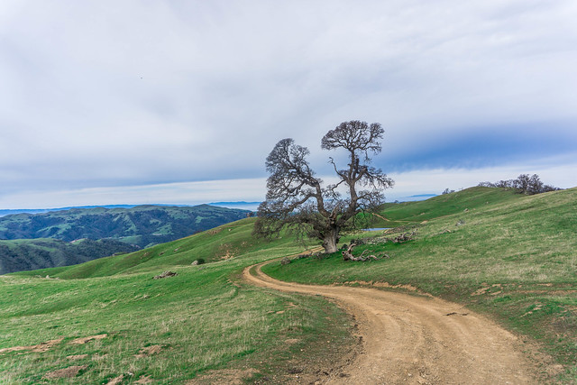
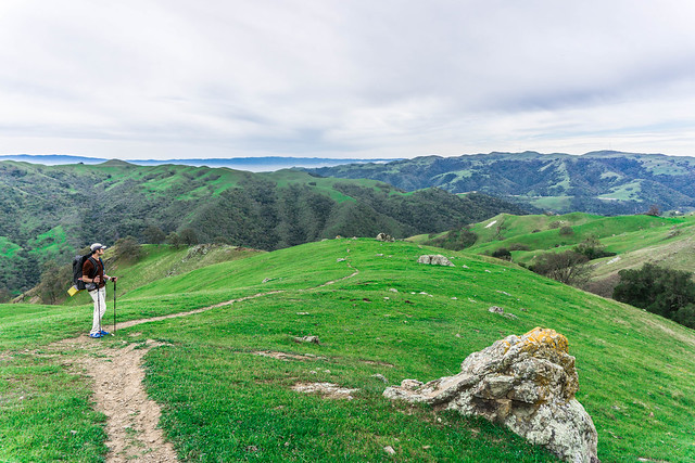
Weather was idyllic, alternating with bouts of mild sunshine and overcast. We were surrounded by beautiful green hills and the first of the season’s wildflowers starting to bloom. Some oaks were budding, others still bare.
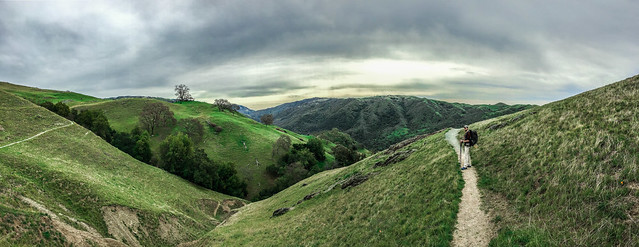
It was simply beautiful.
A note about water – it’s a good thing to fill up and filter at the camps where you can. On the trail, water sources consisted mostly of large ponds pooling in meadows frequented by cattle. Some of the streams we encountered were barely trickles, and looked muddy. There were occasional signs warning of blue-green algae in the water, advising us not to consume it, or even allow it on the skin.
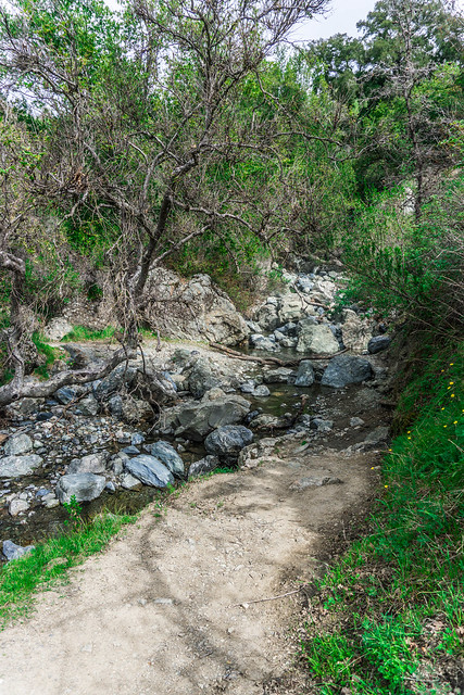
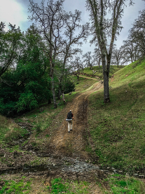
This was the only stream crossing we encountered where the water looked somewhat clean, and was bubbling and trickling merrily away. This was also the stream where I slipped and rejoiced wryly with DD in the trip’s first foot-wetting.
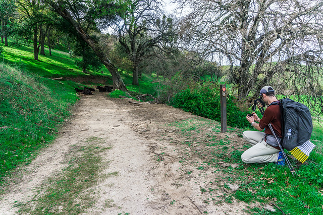
Before we knew it we had passed Sunol Backpack Camp (lots of poison oak around the porta potty area – watch where you set your gear), around mile 6 for the day. Then, barely 2 miles from Sunol Visitor Center, we encountered the couple from Camp #2. We passed them again, and didn’t see them until we were ready to leave from our brief lunch stop. As you approach the center you begin to encounter more and more day hikers and groups of folks out for a walk. Several had their pets with them, and it was nice to see puppies walking the trails. Note, the visitor center sells no hot food – only a few granola bars and candy. Water is available, as are toilet facilities. There are some nice picnic tables under some oak trees.
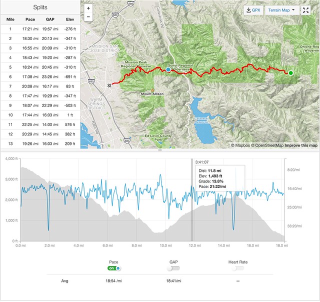
Lunch was brief and we both felt we could continue. Unlike the first day where we were gaining what approximated to around 600′ in elevation each mile for the first 6 miles, this time we we were only experiencing about 380-400′ in elevation per mile, along an equivalent distance.
We saw more cattle, and at one point needed to shoo some away from our path. Luckily, after a brief staredown, these cows didn’t put up much of a protest and moved obligingly.
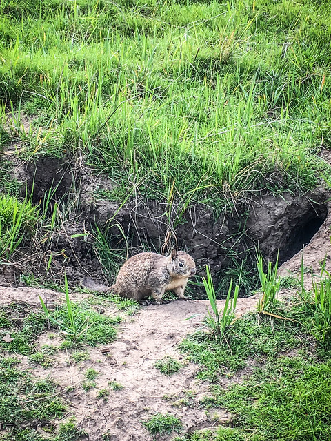
We also saw numerous ground squirrels scampering about in various groups and colonies. This little guy was quite brave and let me come fairly close before scampering away.
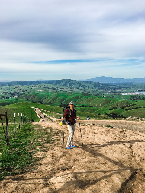
And suddenly we were there at Mission Peak, watching the hoardes of people of all ages, shapes and sizes, variously clad in athletic wear and sneakers and jeans and jerseys, cotton t-shirts and shirts made of technical fabric, some smelling heavily of cleanliness and perfume, others not; hardly anyone with backpacks let alone hiking poles, all making the pilgrimage to the 3rd-highest peak in the area.
We had started from camp at 8:55am that morning, finishing around 4pm in the afternoon. We passed the crowded Stanford Ave. parking lot, and walked a little into the neighborhood to wait for our Uber. Yes, Uber can take you back to Del Valle in around 1/2 hour to 45 minutes for about $36. We were tired but not completely exhausted, and exhilarated by our accomplishment. It was the longest hike either one of us had been on, and we had survived it just fine.
Post Hike Thoughts
- This is definitely not a hike to do in the warmer months. Even the Ohlone 50k race, held in May, seems like it would be unbearably warm (though in the Bay Area you can never tell).
- The course is long and highly exposed. There are few water sources.
- Poison oak lines many parts of the trail. Be careful.
- That section from Del Valle to Murietta Falls was indeed difficult. But I could do it again. 🙂
Gear
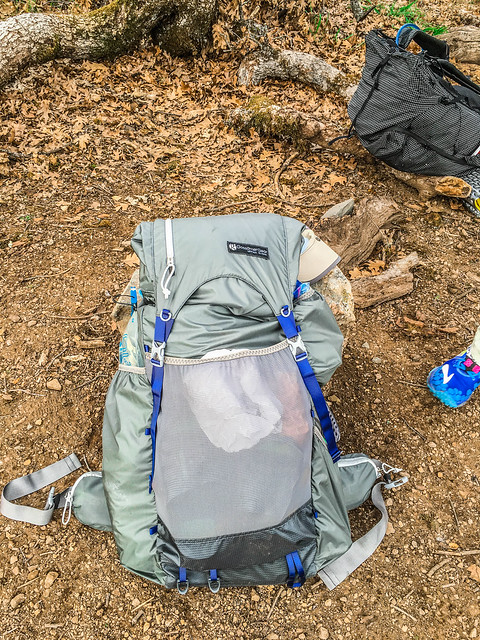
This was my first time bringing out my Gossamer Gear Mariposa 60 to test, fully loaded, in the field. In contrast to my Osprey Ariel 65, which weighs almost 5 lbs empty (78 oz), the Mariposa (medium) comes in at a mere 1.8 lbs (29.1 oz).
It held up well, with minimal aches and chafing. I had previously complained on other training hikes and backpack trips of hip-bones rubbed raw, of shoulders in pain. Not so much this time.
It fit my bear can (the Bear Vault 500) although the canister has to be carried upright. There was enough space around it to fit sleeping bag, air mattress and other gear and clothing. The numerous outside pockets were also fantastic and made for easy access to various items (sunglasses, sunblock, wag bag kit). So far, so good.
Post
- See an account of Day 1 here.
- More photos are on Flickr here.
Pingback: Hiking the Ohlone Wilderness Trail Day One | Legs, Engage!()