2 April, 2016. 13.2 to 13.67 miles, depending on which tracker you believe.
One of the hikes we’ve had on the list was a fairly lengthy one on Mt. Diablo. We projected that we’d need to do this hike soon, in the Spring, before it got unbearably hot. I had run Brazen’s Mt. Diablo Half Marathon almost around the same time the year before, and found that I got really lucky with the weather, where it was only in the mid-70s by the time I finished. This hike’s forecast turned out similarly, relatively mild, where the highest temps forecast were also in the mid 70s.
We took as our guide Alice Hikes’ most excellent account. I was torn between wanting to spend time with puppy, errands, keeping up with my running — fitting in a long run during the week — and other assorted house stuff before my DC trip, but finally decided that I wanted to go with the group.
So the day before I ran a standard short-long run of 10.3 miles. The legs felt ok in the morning, and I managed to wake early enough to give Harlow some runaround time at Kezar Triangle before we left.
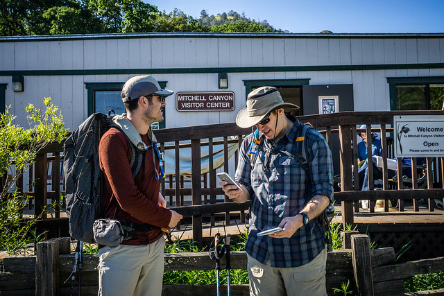
We parked at Mitchell Canyon Visitor Center. At 9:45am, the parking lot was already full, and we had to go to overflow parking. After the desultory unpacking of the car and the rubbing on of sunscreen, we set off, but first used the bathrooms by the visitor center. Small clusters of people milled out, and I heard snatches of “Are you here for the butterfly walk?” and other chatter.
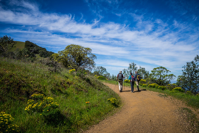
We basically would follow the path recommended: Mitchell Canyon Road –> Deer Flat Road –> Juniper Canyon –> Summit Trail Road –> Summit. Then back down along North Peak Trail –> Bald Ridge Trail –> Eagle Peak Trail –> Coulter Pines –> Oak Trail –> back to Mitchell Canyon. All told, we’d be hiking around 13+ miles.
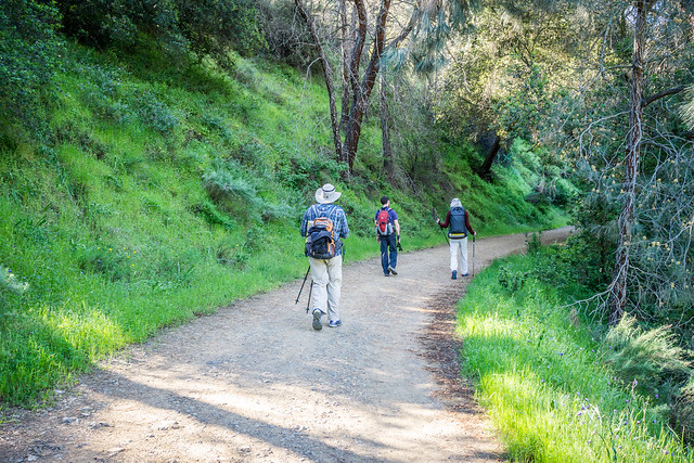
The first few miles on Mitchell Canyon Road started out relatively flat, with very gentle inclines. A couple of us had expected a slog through expanses of exposed trail, and were glad to amble along some tree-lined segments.
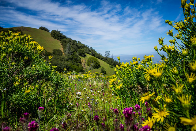
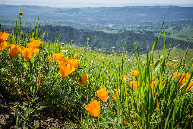
The trail is undeniably lovely in the Spring, when all the wildflowers it seems, puts on their happy, bright displays.
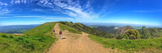
And the views – pretty epic.
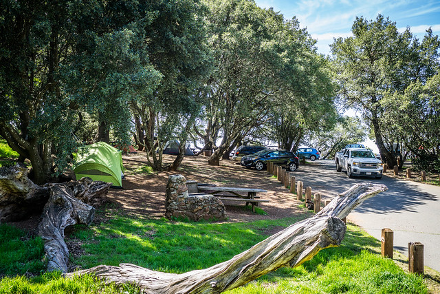
After a while we stumbled upon Juniper Camp. The group campsite looked a little busy, non-private, and crowded, but there were smaller sites up ahead on the trail that seemed a little more secluded and had the benefit of being tucked further off from the busy road. There was also a sparkling, seemingly very new building of showers and toilets and sinks.
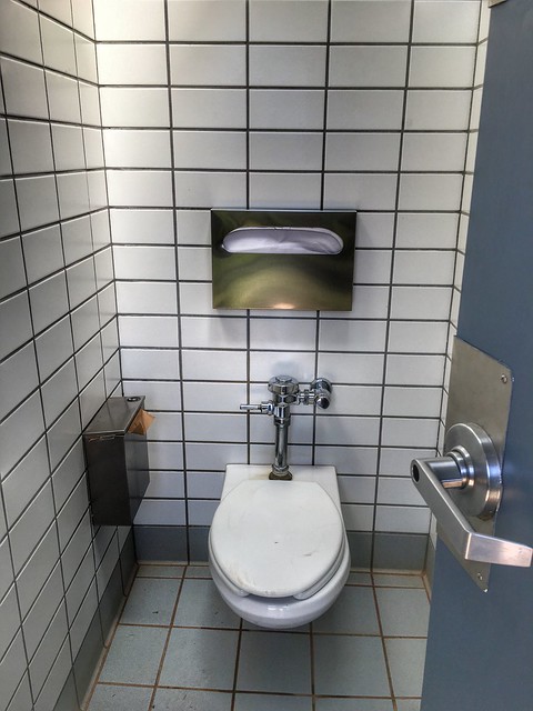
The toilets even smelled remarkably clean.
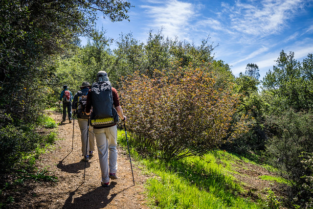
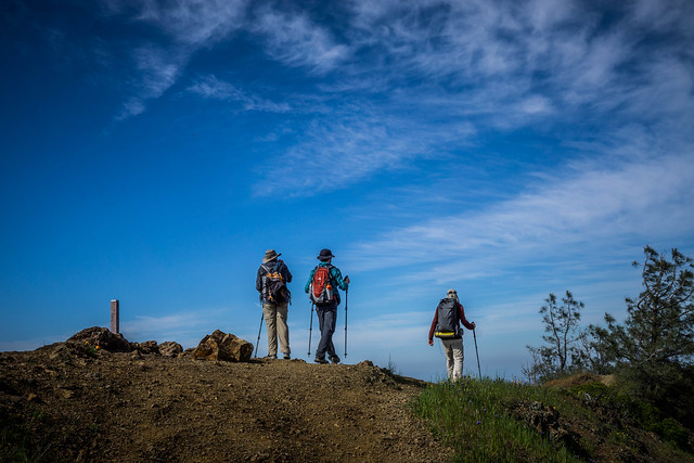
At the Laurel Nook picnic area, we began the 1-mile ascent to the Summit of Diablo. There had been a lot of poison oak along the trail, which was fine when the trail was nice and wide – a fire road, really. When the path narrowed, one needed to be more careful.
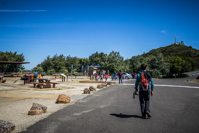
Eventually, the trail spat us out onto a very wide expanse of parking lot and picnic tables – the Lower Summit Picnic area. Children ran around, screaming and brandishing sticks. It was the weekend, after all. We used the very clean toilets again and filled our water bottles. Though not as not as it could have been, I had easily polished off a litre of water in about 6 miles. Unusual for me, and also a testament to the increasing temperatures, which were still relatively mild for Diablo.
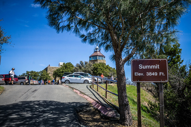
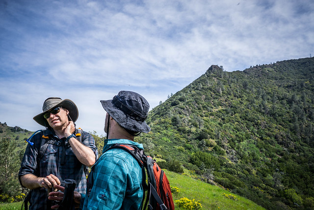
We took a small little trail past the parking lot to the summit, having to pass a very large family with numerous, small, noisy children. The trail was somewhat marginally better than the paved road with cars zooming to the top. The Summit observation tower and visitor center was similarly crowded with cars and people all milling about and seated on every conceivable surface.
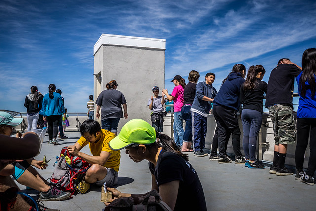
Luckily the guys managed to get spots in the shade on the observation deck so we could eat lunch in relative comfort while I was checking out the visitor center and buying a map. Yes, there is ice cream sold at the Summit Visitors’ Center. (It’s not great ice cream, but palatable. There are ice cream sandwiches and chocolate-and-nut-topped drumsticks available, for those who are curious.) We sat next to a group of young folks who expressed interest in Danny’s Zpacks Arc-Haul Zip Backpack. It sounded like they, too, were familiar with ultralight gear and backpacking. Later, we were to leap-frog with them on our descent from the summit.
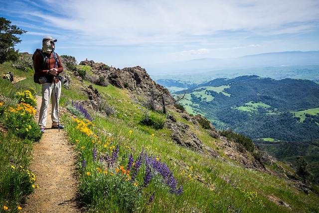
The trek out took us up-and-down to a couple more minor peaks, along Bald Ridge to Bald Knob (2645 feet), and eventually, down and up to Eagle Peak (2369 feet). In contrast with the bulk of our first hike, the ridges we walked on were mostly single track, dropping off on one side. Some segments were beautiful, lined with wildflowers of all colours.
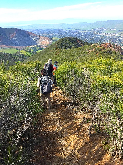
Other segments were crowded with overhanging and overgrown brush — quite a bit of it poison oak — and it was all we could do to negotiate the encroaching foliage, and navigate some of the treacherous downhill, steep and slippery with loose rolling scree, or wobbly lodged rocks. I was grateful for the single hiking pole that DD let me borrow, as I had forgotten mine at home.
And still on other parts of the trail clouds of gnats hovered so thickly in humming clusters that we had no choice but to try to breeze through them as quickly as possible, trying to cover our faces and eyes and mouths and wave them off during our traverse. Once we were out in the open, we found flattened gnats all over our clothing and hair.
The segment up and down Eagle Peak was definitely challenging, as one has to climb up a knife-edge ridge which rises and falls and drops steeply off on both sides, so it’s more than a little scary. DD, in particular, managed to barely stave off a panic attack due to acrophobia, as he barked out to us all to “just keep moving, just keep moving…”
My quads began to complain on the descent. It was the end of the day, we had gone some 11 miles, and I wished that I was unencumbered by my pack and wanted to be off and jogging down the trail instead of making our way mincingly, painfully, bit-by-bit. Indeed, that’s what I ended up doing for perhaps the last mile or so. Running/ jogging the downhills is definitely easier for some reason.
We were glad when it was over. We headed into the Mitchell Canyon Visitor Center area and collapsed on some picnic tables. Another hard training hike in the books.
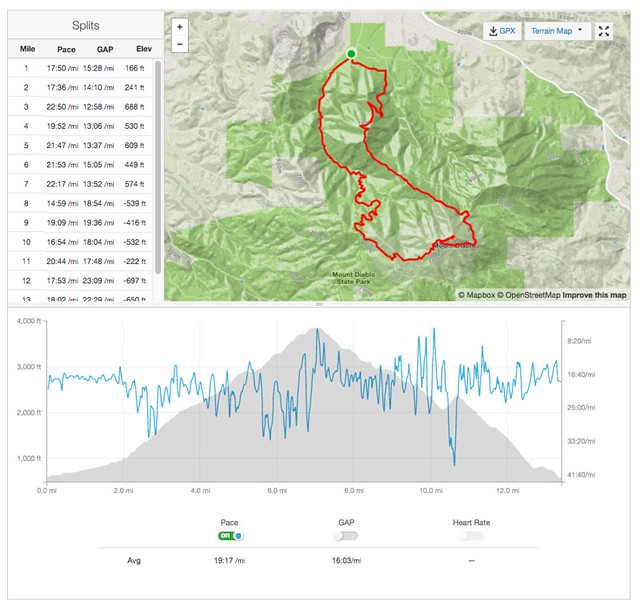
Our mileage trackers provided some laughingly disparate distances:
- My Garmin 920xt: 13.67 miles
- Danny’s Runkeeper: 13.29 miles
- Strava, which takes my uploaded Garmin GPX file, parses it, and features only moving time: 13.4 miles
Other photos can be found on Flickr here.