23 April 2016. 14.62 miles, including ascending the Hobbs Road Short Cut.
The trip started out a bit inauspiciously, as I had zoned out and missed the E. Dunne exit from 101 South. DD rerouted us back through Gilroy on some surface streets, and my detour ended up delaying our start by only about 10 minutes.
Henry Coe is out in Morgan Hill, and driving to it from the freeway exit requires an extra 13-mile slow slither along a narrow and windy road that snakes through a residential area and then past Anderson Lake Park, climbing, climbing, hair-pinning up to the top, where E. Dunne dead-ends right into the Henry Coe Visitor Center.
The trek we were planning had a reputation for difficulty, most especially a segment of the trail called the “Shortcut,” which apparently, is a very steeply graded slope covering 1500 feet in about 1.5 miles. DD had prepared me for it by saying it was “like the Warmup and Big Burn on Ohlone.” And so, by reading through a couple of other blog posts and trip reports, I felt mentally prepared. I carried with me mostly water weight – about 4 litres total, including one Nalgene of electrolyte drink, which I mixed up before we left.
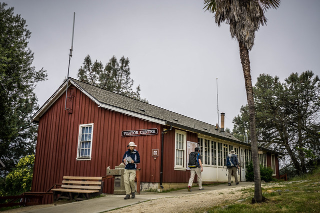
It was foggy and overcast when we pulled into the parking lot. I was excited about the fog and cool weather; indeed, forecasts had indicated that the highs were going to be somewhere around only 69 degrees. To our right, a couple was getting out of their car. We discerned from their backpacks and other gear that they were going to be camping/ backpacking. We all trotted off to the visitor center to use the bathrooms, procure some maps, and perhaps get some guidance from a ranger.
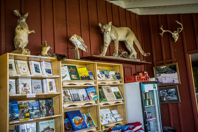
The free map that comes with the park brochure, while informative, turns out not to be the most accurate. Note: Mt. Sizer is in a completely incorrect location on this free map. We instead purchased the Pine Ridge Association map for $10, produced by the eponymous nonprofit that supports the park. It’s a nice, large, topographical map, printed on water-resistant paper. Mt. Sizer is correctly located on this map. I also took the opportunity to purchase a nice wildflower brochure plucked from the merchandise shelves, upon which perched some very interesting stuffed furry friends.
The route we’d planned: a clockwise ramble from Coe HQ –> Monument Trail –> Hobbs Road –> Blue Ridge Road –> Jackass Trail –> Poverty Flat –> Corral Trail –> Coe HQ.
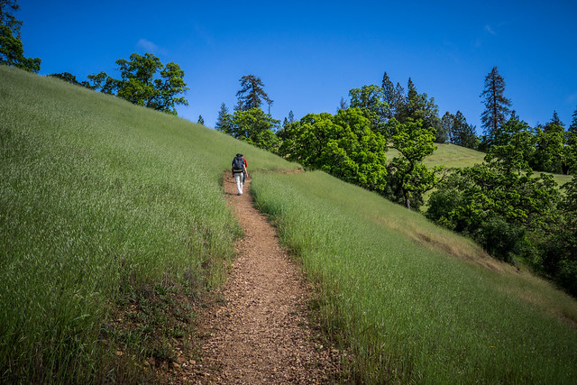
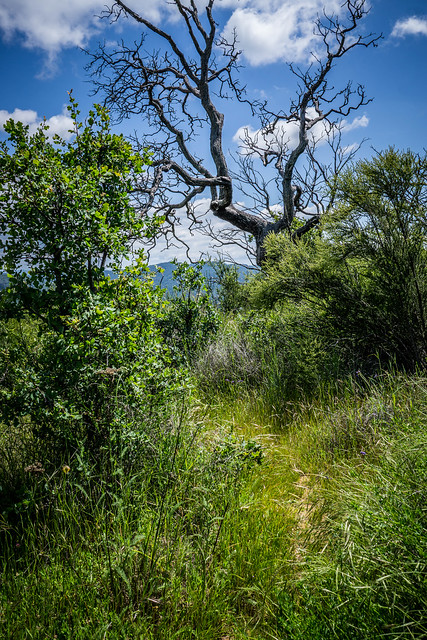
Starting out from the visitor center parking lot, the climbs on Monument Trail begin almost immediately, which warmed us up nicely.
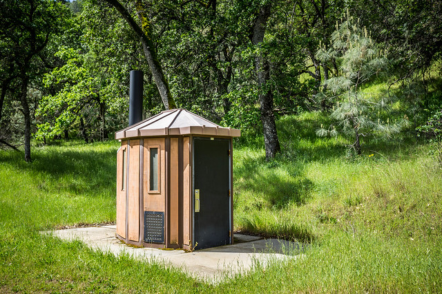
We passed our first campsite around Frog Lake, where there was a nice porta-potty pit toilet and someone’s pitched tent. A group of 4 cyclists passed us and made their way up the hill. We followed suit and descended to Deer Horn campground, where there, right on the trail, was another new-looking fancy outhouse. It was also nice and clean and well-stocked inside.
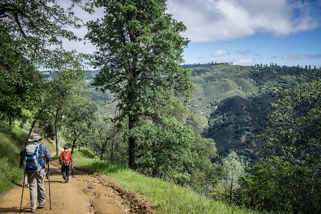
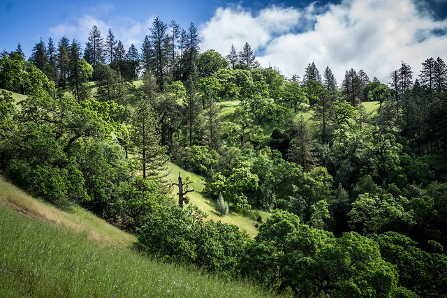
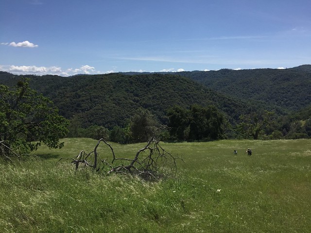
We began another long descent, all the while looking up to the ridge where we would presumably climb.
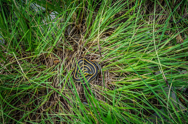
There were a couple of creek crossings, one of them right at the foot of the dreaded much-anticipated Shortcut. Just as I was about to cross the creek, I accidentally poked this little fellow. It must have been cold, as it didn’t move, and only flicked its tongue at us in annoyance. I made my apologies and proceeded to cross the water, only getting my left foot a tad damp.
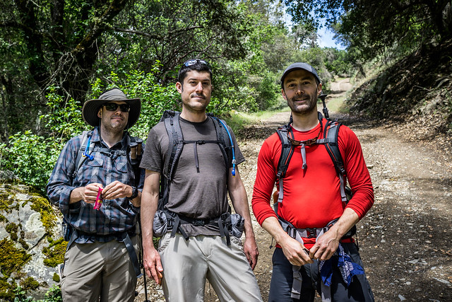
After the requisite “before” photo, and once the boys had set their timers (after reading somewhere that this was a ‘thing,’), we were off! Or rather, Mike charged up ahead with nary a “see you later,” leaving the rest of us slogging up the incline. I eventually dropped behind DD. Jared, hauling some 20+ lbs in his pack that day, brought up the rear.
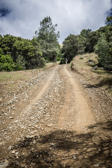
Yes, this thing was hard. I had to stop several times (more than I care to remember), huffing and puffing all the while. Having electrolyte drink helped, if only to give me a mental as well as negligible physical boost.
I would pause, take a swig from my Nalgene, and sometimes take a few snaps of my surroundings. I tried to keep my mind off the fact that the segment just kept going on and on and on… The little pauses and rests helped to some small degree. I would feel somewhat energized starting out again for about ten seconds, before my legs began to protest and the heart began to hammer. Sweat was dripping profusely off my visor. And yet, there was an end, and before I knew it, there were some cheery haloos not 500 feet away and DD and Mike were calling to me. Mike had made the climb in 37 minutes; DD in 39. My time came in around 43 minutes; Jared came not long after I did, perhaps some 5-6 minutes later.
If there were views at the top, I did not see them. There was a lone bench there, which the boys used to stretch out, and unpack our various lunches. I was mostly preoccupied by trying to dry off the top of my backpack, which was wet with sweat that had poured from the top of my head on the ascent. There was also a stiff breeze, and while I appreciated the pleasant oaks that cast our resting area in dappled shade, I, along with the boys, quickly began getting cold. Vests and windbreakers came out from packs; people started muttering about moving on.
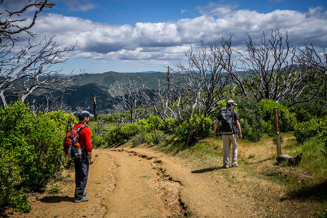
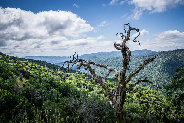
And so we set off on Blue Ridge Road, choosing to pass on going to the “top” of Mt. Sizer itself, which is oft-described as being a “bump” purportedly only a few more feet above where we already were. Instead, we sought to warm ourselves by getting out of the forested areas and back into the sun. We soon encountered one of the burnt out areas from the 2007 Lick Fire, which raged over 47,000 acres of the 87,000 acre park. We also paused a bit here since DD’s tummy problems were starting to worsen and Jared and Mike rummaged through Jared’s medical supply kit to see if there were any antacids DD could take. Unfortunately, there were none.
There was a nice sign-post at the junction of Blue Ridge and the Jackass. Earlier trip reports had indicated that the junction was difficult to find, due to a burned/ missing trail sign. We had no problems this time. I had also joked near the beginning of our hike about whether the trail was named because those traversing it deserved the same designation. We were about to find out.
And so we embarked on Jackass. I soon began to suspect that what I had joked about earlier was indeed true.
It became a sort of a semi?bushwhack with overgrown grasses and other shrubs, and yes, a goodly amount of poison oak that we had to squeeze by. But it was a nice and gently sloping trail for the most part, and DD said that I flew down that segment. For me, it was a matter of trying to get away from the poison oak. DD was certain that I had brushed it with my right hand at one point, but, now, several days later, I appear to have escaped unscathed again.
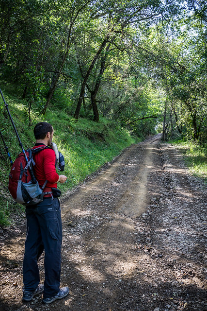
Jackass trail T’s into Poverty Flat Road and from there it was another gently rolling descent down to the campsites along Coyote Creek. DD’s tummy was really not happy at this point and it was all he could do not to knock over the ranger who was servicing the porta-potty in his eagerness to get in. While we waited, we chatted a bit with a group who had come hiking up, apparently on a shakeout trip to test out their new ultralight backpacking gear. This was the section where we saw the most people that day – groups of hikers and backpackers heading towards the various campsites in the area.
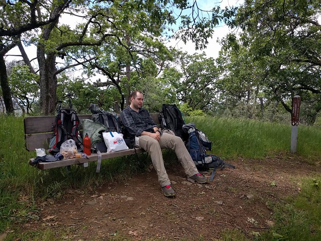
And then, it was another brief respite at a picnic table near one of the campsites, where Mike stretched and some of us ate some more snacks in preparation for the 1400 climb back up to Coe HQ, where we had started. The climb started again, after a stream crossing. In retrospect, the grades were somewhat gentler, and interspersed with a fewer more flattish interludes than the Shortcut.
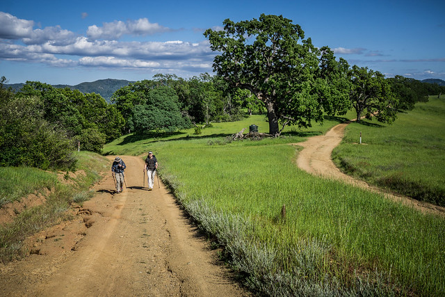
Finally, we were in the home stretch as we approached the intersection of Manzanita Road and Poverty Flat. From there, it was a only a couple of miles on fairly flat paths back to Coe HQ.
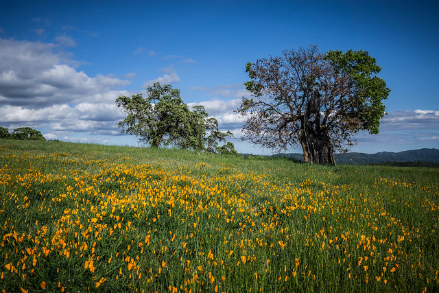
The meadows we passed were dotted with an abundance of poppies – they must have been very striking earlier in the day when they were wide open.
We stumbled back into the old ranch buildings of the visitor center around 5:30pm. All in all, we had been out on the trails for about 7h15m (including breaks), for a distance of 14.62 miles. We were all glad to be done – that was a tough hike!
Miscellany
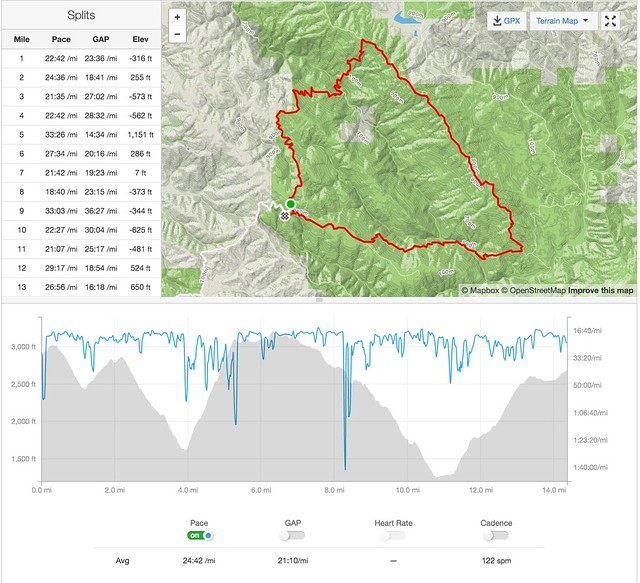
- The Strava data screenshot above is made up from a GPX file from my Garmin. I started my Garmin late – 7 minutes after DD started his. I like the Strava elevation profile and visualizations.
- Here’s DD’s Runkeeper record.
- I wore my new Brooks Cascadia 10s. They were nice and comfy. Think Cascadias will be my shoe of choice for the JMT.
- Water sources were abundant, but you will need to filter/ treat. I did not see spigots or piped water at any of the campsites.
For those of you who eventually go on this hike, drop a comment to let us know how much you enjoyed it!
Pingback: 21-Jan: Grizzly Gulch Falls at the Coe – Backyard Sam()