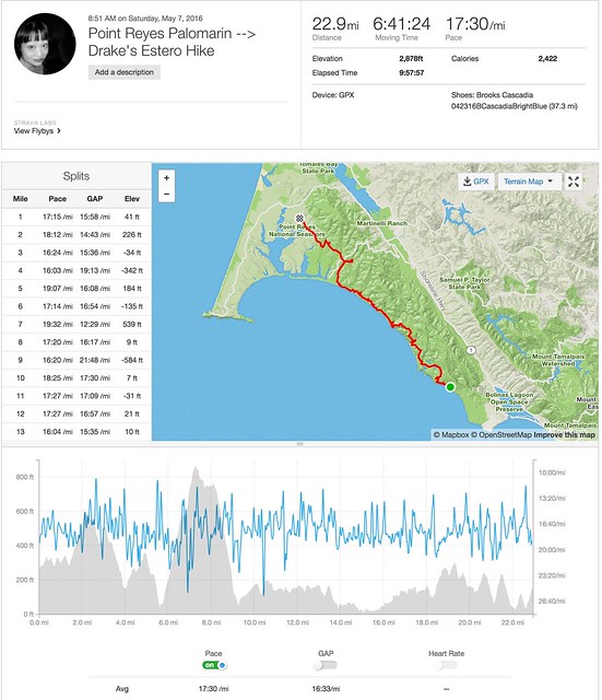
7 May 2016. 22.92 miles, with a nice stop at PRNSA’s Fireside Chat.
Another weekend, and another long hike. At the house, we’ve gotten into some sort of cadence with each other’s schedules, which means DD almost always schedules a long hike on Saturday, and I’ve been alternating my long run-weekends with joining along on those long training hikes every other Saturday.
He was fresh from the exhiliration of a successful and relatively pain-free Skyline-to-the-Sea 27-mile day-long, thru-hike with Justin the prior weekend, and was looking to extend his collection of 20-plus milers.
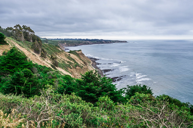
Our 24-mile path would have us launching from Palomarin, at the popular trailhead for the hike to Alamere Falls, then heading north on the Coast Trail until we reached Limantour Spit Road. There, if our timing was just right, we’d be able to take a detour to the Clem Miller Environmental Education Center, where the Point Reyes National Seashore Association was having their annual Fireside Chat for some of their members. From Limantour, depending on how we were feeling, we’d take Muddy Hollow to Estero Trail, and end up back at a parked car at the Drake’s Estero.
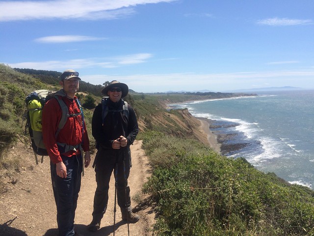
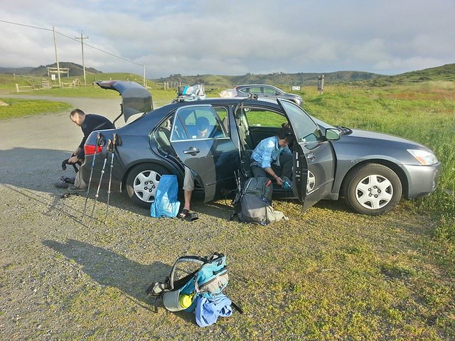
We definitely nailed the timing for the day, as was needed for this kind of a hike. We were doing a point-to-point, and so we had to meet collectively at one trailhead, then shuttle a car with all the participants to another trailhead. For this particular hike, this meant leaving the house on or before 6:30am, meeting at Drake’s Estero Trailhead by 8am, and then driving 50 more minutes to the Palomarin Trailhead where we would start our hike.
We seemed to be early/ on time for everything that day, which was a good thing, considering the hike’s length.
I had trekked with DD and Jared from Palomarin to the perpetually popular Alamere Falls the year before. At the time, it was gloriously sunny, and we were only doing the 8.4-mile out-and-back to the Falls. DD and J. were still practicing with their backpacks and gear, right before they headed off to the Lost Coast, their first-ever backpacking trip. What a difference a year makes!
It was still early enough, close to 9am, when we pulled into the Palomarin Trailhead, and there were still a good number of parking spots, though the lot was by no means empty.
We started on the trail jauntily, hiking at a good pace. Indeed, DD had estimated that in order for us to get to the Fireside Chat by 4 or 4:30, we’d need to sustain an average of at least 2.5 miles/ hour.
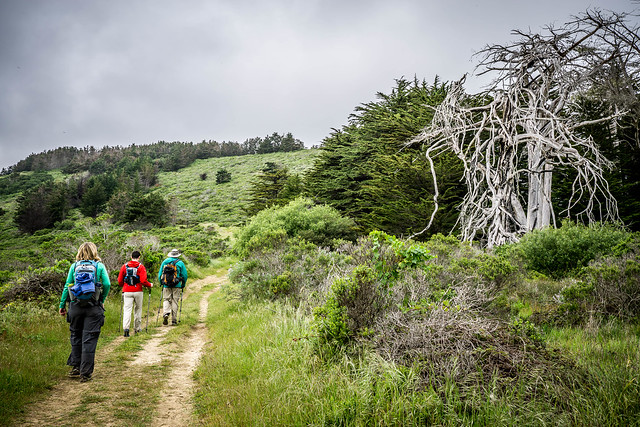
Perhaps because of the relative earliness, and more likely because of the forecast of rain, the trail was fairly empty. We passed only 2 large groups who we surmised were making their way to the falls.
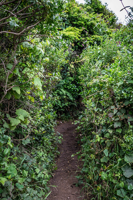
As always, the tunnel of overgrown foliage to Alamere Falls, much of it composed of poison oak, made us giggle. We thankfully did not have to brave it that day.
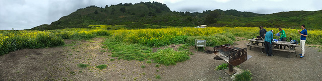
At around 6 miles, we reached Wildcat Camp, where some of us would be backpacking with CJ in June. We paused here – amidst the waving mustard flowers – for a snack. Mike had brought some fancy Cowgirl Creamery Mt. Tam cheese – a foreshadowing of the other fancy cheeses we would encounter later in the day.
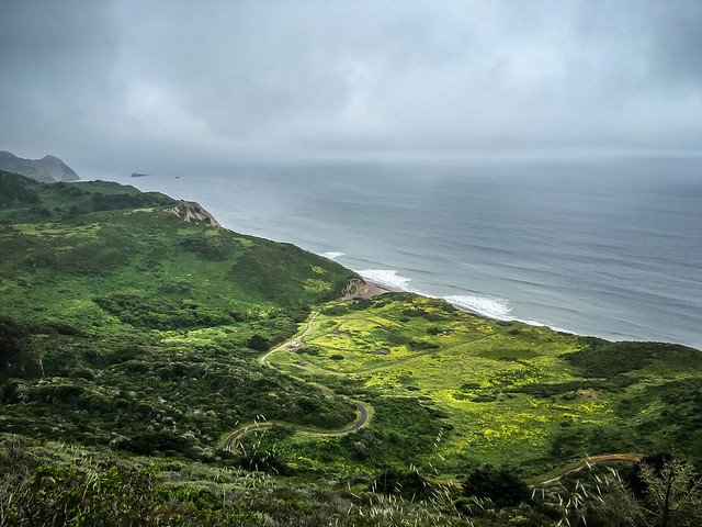
There was a bit of a climb up from Wildcat, but nothing like the Diablo or Sizer ups and downs from prior weeks. It made for some stunning views of the area we had just left, though.
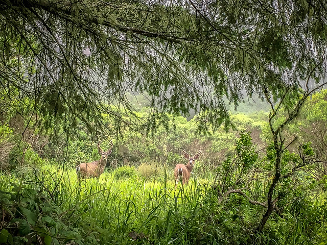
Perhaps the 2nd-most magical moment of the day came when we rounded a corner, and came nearly face to face with a handsome young deer, only a few feet from the trail. It turned and bounded back to a companion who was further away in the forest, but still close enough for us to all get a good look. They were gorgeous devils with velveted antlers, and not as frightened as we thought they might be.
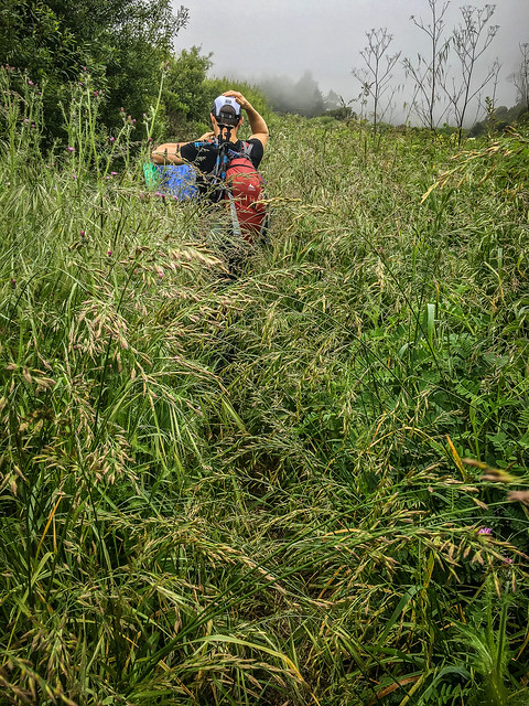
It was clear as we left the well-traversed path to Alamere that there was some overgrowth on Coast. Some of it was very overgrown, with all manner of sharp grasses, stinging nettles, thorny blackberry, and, yes, poison oak. And because it was raining, albeit relatively lightly, the moisture collected on the vegetation we were traversing collected on our pants and dripped down onto our shoes. And in quick order our shoes and socks became sodden, soakingly, squooshingly, wet.

Coming out into the open near the Coast we encountered not insignificant breezes. We were grateful that the rain stayed fairly light.
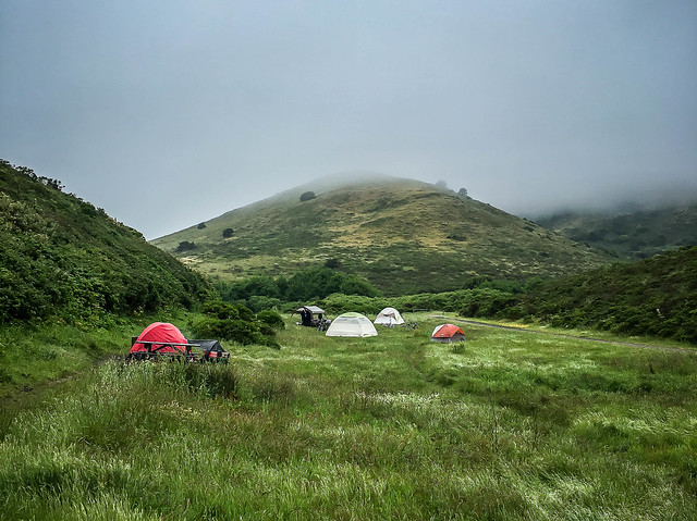
We reached Coast Camp with a mere 3 or so miles to go before reaching the PRNSA Fireside Chat. We had kept up a good pace, despite our stops and pauses, and were on a 3-3.5 mile/ hour rather than 2.5 mph pace. We’d reach the chat an hour early. Despite the rain/ mist/ gloomy weather, there were a few hardy souls – whole families even, with wagonloads full of stuff – camping out there today.
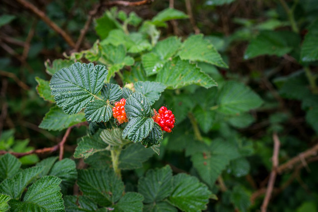
And so we forged on, coming up the rather rocky and bumpy path to Limantour, seeing a few more people on the trail as we popped out by the Point Reyes Hostel. We spotted several of these berry bushes, with the inviting bright red fruits peeking through the greenery. At first we could not figure out whether they were raspberries, or a strange blackberry hybrid. Some searching once at home revealed that these are salmonberries (Rubus spectabilis), a species of bramble in the rose family, and similar in structure to the raspberry. They were an important food source for the native peoples of the area.
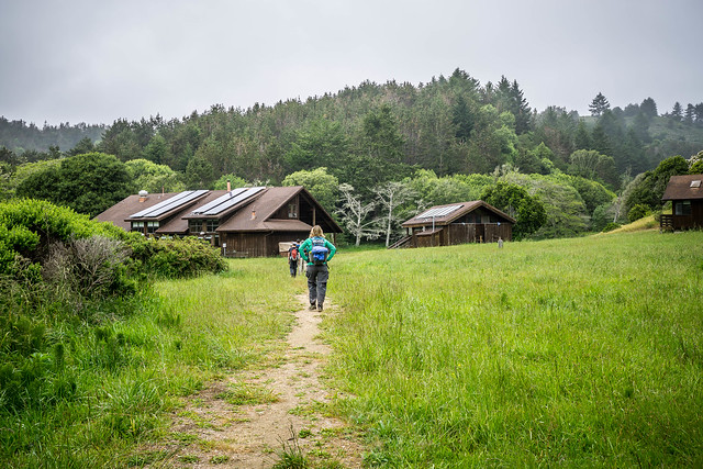
About half a mile more (we went the long way around) and we were soon approaching the Clem Miller Environmental Education Centre from the rear.
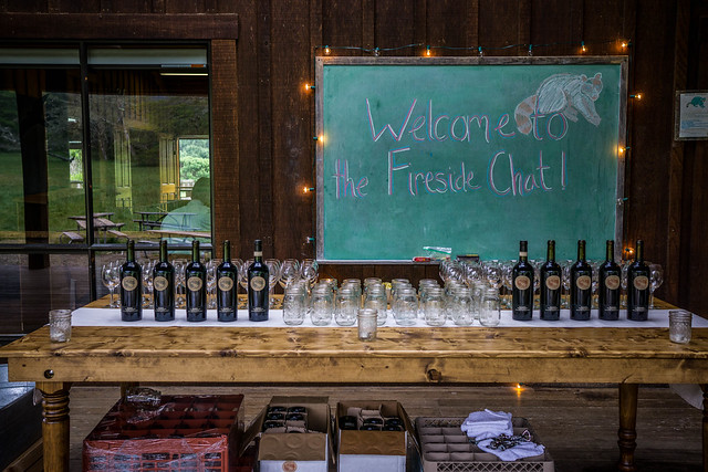
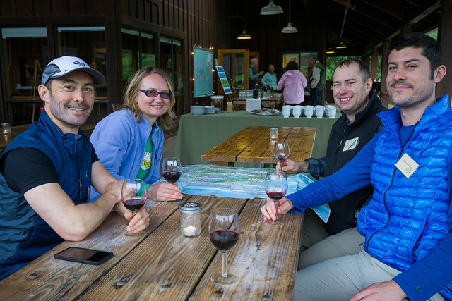
We were still very early, and the first guests there. Nonetheless, Donna Faure, the lovely Director of Development at PRNSA, greeted us warmly and urged us to grab a glass of wine and make ourselves comfortable. After 17-plus miles, walking up to the wine table was indeed a surreal experience!
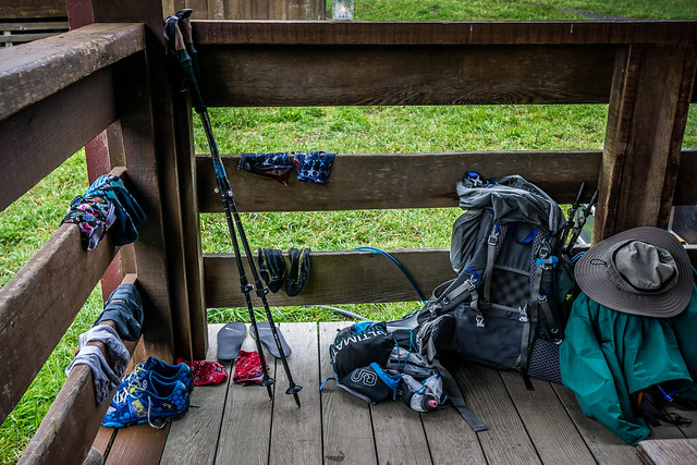
Unfortunately, we responded to the gracious hospitality by claiming a corner of the deck, proceeding to dump our backpacks and strip off our wet shoes, socks and gaiters in an attempt to dry out our belongings as well as our damp feet. Everyone was very kind, however, even offering us rides back to Drake’s Estero if we didn’t feel like continuing on after our food and drink.
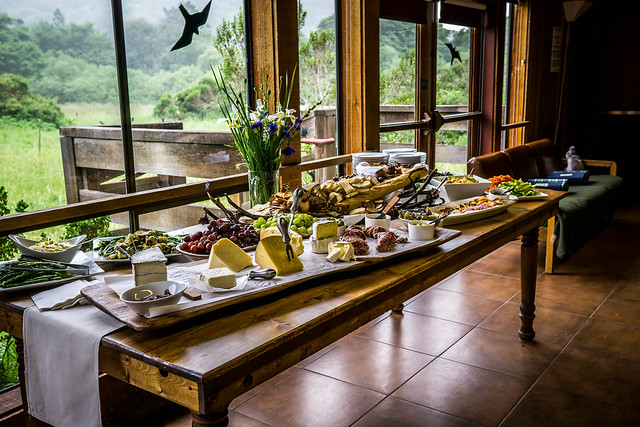
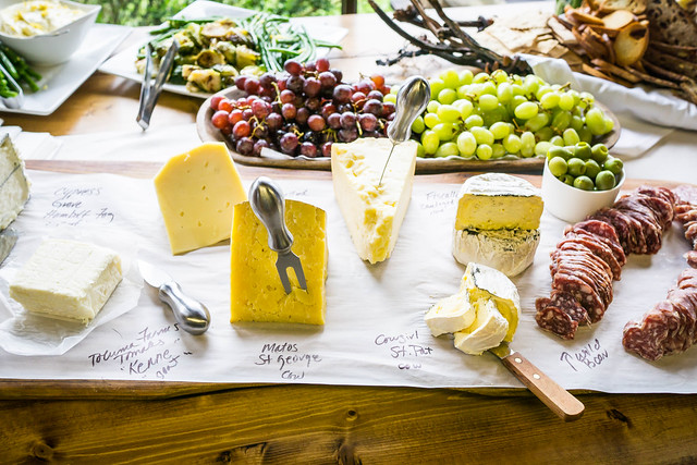
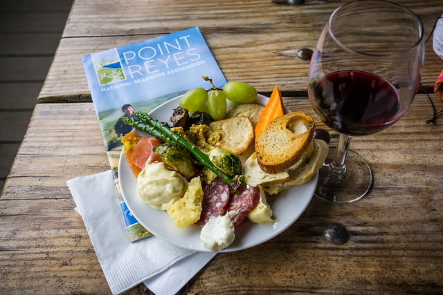
And what a spread! I think some of us might have seriously considered eschewing the last bit of hike, though once DD uttered the words, “We can come back for you,” I knew I had to forge on… as nice a nap by the fire might seem post-noshing.
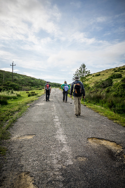
And so we embarked on the last 4 or 5 miles. Mike helped make these last few miles better by offering me his last pair of dry socks! Thank you again, Mike! Fortified by the tasty foods and a little caffeine, we reluctantly left the Fireside Chat as the talks started, heading north on Limantour Spit Road, once again passing the hostel, and then proceeding on Muddy Hollow Road.
The trail was not as muddy or as overgrown as I expected, but there were a few rough spots, and a few picturesque segments.
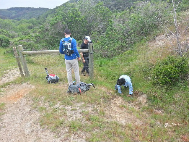
We eventually had to pass through some ranchland, which required some traversing past a barbed-wire fence. Some opted to go over it; others under.
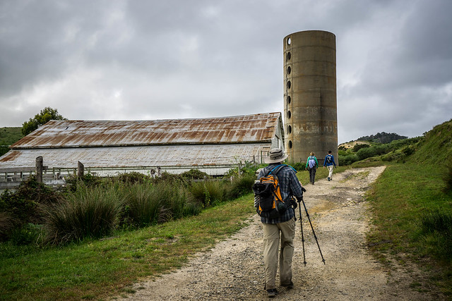
As we approached the ranch itself, and began to skirt around it, we suddenly heard the low rumble of an engine. The farmer had come out on a small tractor to tell us that were going in the wrong direction, and invited us to pass through the ranch proper. But, she also indicated that we were to tell others not to come this way in the future…
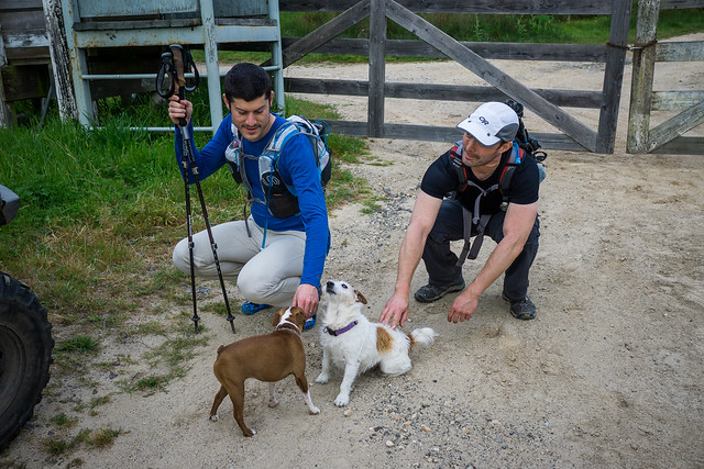
She did have a couple of awfully cute dogs, though… one of them especially demanding of Mike’s attention.
And so it was through her ranch, and then a few more steps up an insult hill to the car parked at Drake’s Estero. We arrived close to sunset. All in all, the hike had taken us around close to ten hours, including our stops and breaks. Moving time, however, clocks in at around 6:41, according to Strava.
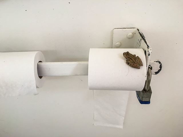
We were glad to reach the car, and also quite amused to find one last surprise in one of the trailhead bathrooms.
Miscellany
- Flickr photos
- Runkeeper tracking
- Magical moment #2 of the day: as we drove away from Drake’s Estero on Sir Francis Drake, we suddenly spotted a doe and her young fawn crossing the road. Momma made it to the other side and bounded up the slope in quick order; the fawn, possibly confused by the oncoming car and the disappearance of its adult figure, bucked along the side of the road near the slope momma had just ascended. Jared slowed his car waaaay down to ensure that other cars following behind would also take heed of the adorable fawn, which looked like it was prancing along at this point. Thankfully, no other cars approached from the opposite direction. Finally, the fawn dove into the bushes and looked like it was about to make the scramble up the hill. We hope it eventually found momma.
- Not so magical moment of the day: Driving up Highway 1 from Bolinas/ Stinson in the dark is no fun.
- We saw lots of wildlife and not-so-wild-life that day: deer, cows, horses, rabbits, a couple of dead or ailing mice, a very large, very dead snake, a couple of large, beetle-like insects, slugs, and a whale (thanks to eagle-eye Jared).
Strava Visualization:
Big thanks again to the Point Reyes National Seashore Association for being such kind hosts (and the best aid station ever)!
Pingback: Skyline to the Sea Day 1 | Legs, Engage!()