
Wine Country
So it is looking like this is the year of the back-country thru-hike. In April over an extended weekend, Danny, accompanied by Jared and Jesse, hiked the Lost Coast Trail – a point-o-point course along the beach in Humboldt County – Danny’s first-ever backcountry backpacking trip.
And so the fire was lit. I’m now accompanying him on my first-ever backpacking trip in a couple of weeks – the popular Rae Lakes Loop that traverses Kings Canyon/ Sequoia National Park. Running/ hiking trails is one thing, but hiking a thru-hike, with significant elevation and carrying gear of 20-35 lbs on one’s back is another.
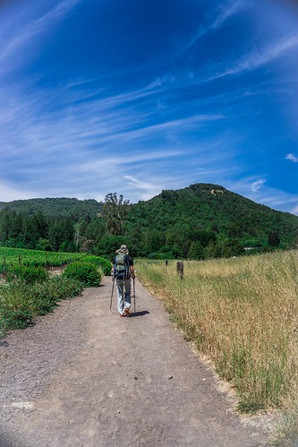
Danny chose Jack London State Park in Sonoma as the site for the next training hike; he and Jared had gone on a couple of training jaunts prior to Lost Coast. This route had some elevation, and it would be a good test for me to finally schlep a pack with some weight and see about some new gear.
I used the Osprey Ariel 65 backpack I had obtained for Thailand. While not the lightest pack necessarily, it makes Outdoor Gear Lab’s top pick. There has been a lot of perusing of Outdoor Gear Lab in this house lately. I ended up putting some 23 lbs inside, including a small lunch and snacks. Danny insisted I carry 3 litres of water – it was supposed to be very warm in Sonoma.
On our way
And so we set off, after a bit of a late start. We met a nice woman, who, upon taking one look at our packs called out – “Oh, are you training for something?” To which we replied – “Yes, Rae Lake Loop in a couple of weeks.” She happened to be running the trails and was married to someone on the board of the organization (Valley of the Moon Natural History Association) that helped manage and maintain the park and keep it from being closed back in 2012.
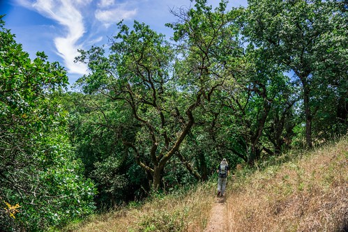
Part of me wanted to explore the historical parts of Jack London’s ranch buildings, but we were there to get some time on feet with equipment, weights, and poles and so we did just that. The plan – wend our way to the highest point of Sonoma Mountain following, in various order, Lake Trail, Mountain Trail, and then the Sonoma Ridge Trail with some long switchbacks and a peak that managed to be both anticlimactic and exciting both.
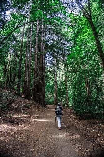
Thankful for the shady trails
Overall, the hike was very pleasant. Most of the trails carried us through well-shaded tree-lined paths. Poison oak was beautifully green and plentiful along the trails as well, but thankfully maintained enough that the plants did not actually encroach upon the walking paths.
Hiking with a full pack definitely slows one down. I only carried 23 lbs, but that weight was sufficient for me to realize that my pack needed to be adjusted better. The waist straps sat on the fleshy part of my hips/ rump and dug in. The chest straps also seemed to press into my collarbones, and my bra straps appeared to aggravate that pressure as well. Afer the hike, I had some raw-looking longish, horizontal bruises along my hips. My collarbones seemed a bit red, and were tender when pressed, but did not seem to be as affected as my hips.
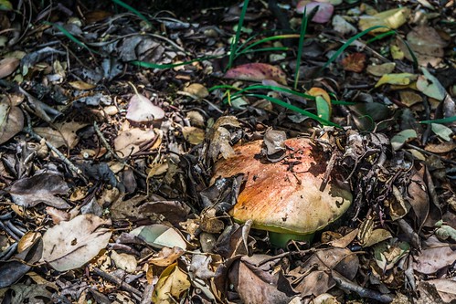
Could it be? It was.
At the top of Sonoma Ridge Danny found a nice, mossy log under some trees that seemed to be a perfect lunch spot. And there, a little behind the log, as if a sign from the gods, Danny spotted what turned out to be a fairly large Butter Bolete, just peeking out from beneath the duff. Upon closer inspection it turned out to be in pristine condition, much to his glee.
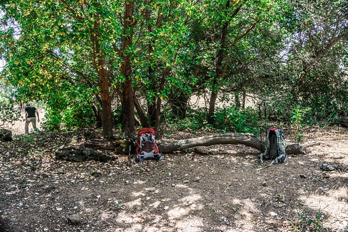
Our lunch spot
Lunch was a 2.5 oz. packet of Tuna each (Danny felt he could have used double the amount), some Ritz-like crackers, and baby carrots. Tuna packets are definitely going into the Rae Lakes meal plan.
The only not-so great part of the hike: Mosquitoes! ~10 bites or so – all on my arms, and for the most part inexplicably mostly around my elbows. Danny was annoyed at me for wanting to apply Deet, so I didn’t. I need to try out wearing exOfficio Bugs-away mesh hoodie I ordered, even if it’s a tad warm.
Sonoma Ridge Trail
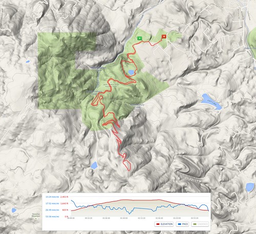
GPS of our route
The hike was around 9.5 miles or so, with 1562 feet in elevation gain. And it was definitely toasty-warm by the time we emerged from the trees, so I was glad for being spared the worst of the warmth, despite our late start.
More photos here.
Pingback: Rae Lakes Loop Day Zero | Legs, Engage!()