Tuesday, 28 July 2015. Victoria to Pachena Bay; then Pachena to Darling River, 8.7 miles.
The alarm went off at 5:15am, so we could take our last showers before our 6-day trek in the wilderness. 6 Days with 2 outfits, 2 pairs of underwear (DD brought 3, which made me jealous), 2 pairs of socks and sock liners.
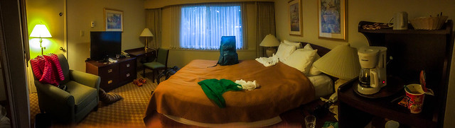
We also made hotel coffee, and slurped down some Shin Ramyun ramen we had found at the 7-11 the night before. 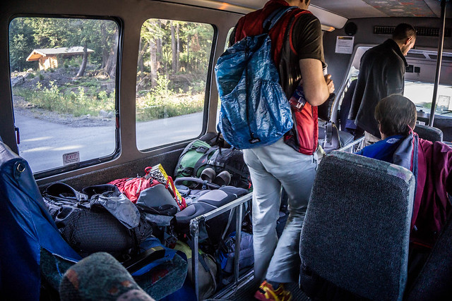
We made it to the bus in about 10 minutes, just 5 minutes shy of the 6:45 deadline. There were still good seats, and room for our backpacks. The driver, probably taking pity on me because of the size of my pack relative to my short stature, helped me place my pack into the backpack bin that replaced seats inside the bus. “My, that’s a beauty – very light,” he said approvingly. DD whispered to me later that he very clearly noticed that the driver did not extend the same courtesy to him, nor with another, taller girl behind us, who appeared to have a bigger backpack than DD or me. And we were off.
The first 3 hours of the ride or so went fairly smoothly. Along the way, the bus driver let out a hiker who was planning on hiking the Juan de Fuca trail overnight from South to North. At around 9:30 we stopped at Tomi’s in Port Renfrew, near the southernmost trailhead at the Gordon River. After pointing out the amenities – washrooms, food at Tomi’s, including coffee, the driver left again to drop off some more folks hiking Juan de Fuca North to South.
We used the washrooms, and DD and I decided to order a breakfast sandwich of ham and cheese. DD suggested that we share one at first, but I said that I wanted my own. That turned out to be a good idea. Fueling constantly and well turned out to be a good lesson for the rest of the trip.
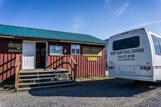
After Tomi’s we proceeded to the Parks Canada information centre at the Gordon River trailhead where we dropped off the only hiker on the bus who was planning on doing the trail South to North. Most folks opt for North to South, where the hike starts out easier and becomes progressively more difficult, the rationale being that one eases into the hike, and towards the end, one gains their trail legs with lighter packs. South to North hikers tend to want to get more difficult parts over with early in the hike, while they’re fresher. At the Parks Canada visitor center there is a porta-potty – this will be the last actual toilet on the road to the Pachena trailhead, though our bus driver stopped twice more along the way for bio-breaks. But these stops were next to the gravelly logging roads with little to no privacy. A couple of women opted to take their breaks anyway.
The last 2 miles of our bus trip took 3 hours since we were rolling and rocking very slowly on bumpy, gravelly logging roads. Our driver also courteously pulled over to the side whenever any large logging vehicle looked like it was going to pass us.
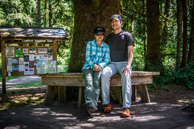
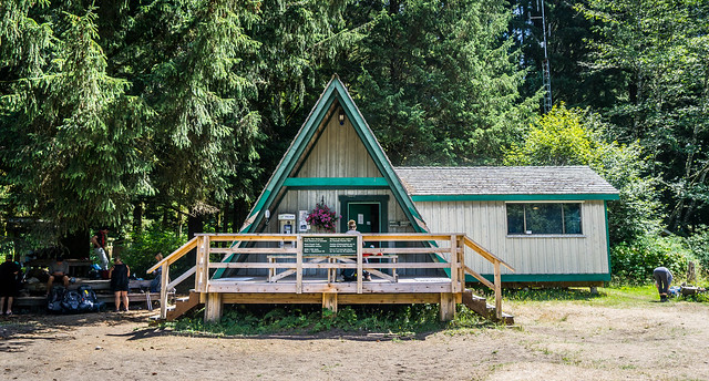 We finally reached the Pachena Bay trailhead around 12:45pm and rolled off the bus. After briefly checking in at the Parks Canada office, we were handed our maps and permits and informed that our orientation would begin at 2pm. We spent our spare time reading the various notices posted on the board inside the ranger station, as instructed, noting various items such as bear sightings by the Michigan and Darling campgrounds; the time for the Gordon River trailhead ferry; the fact that Klanawa campsite is closed and that it’s difficult to find water after Tsussiat Falls through the Dare River… We chatted a bit with a group who had finished their northbound hike, taking 7 days and 6 nights to complete it. Even then, the woman I spoke to felt that they had been a bit rushed and would have wanted some extra time to just chill and enjoy a particular place.
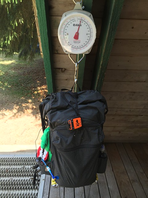
DD and I measured our packs again on the scale Parks Canada provided, and saw that they came out to 22 lbs for me and 23 lbs for DD. A woman who had been part of the group we were speaking with looked rather askance in what appeared to be a little shock or disbelief once she heard how light our packs were.
Some nice guys from Belgium who were starting on the trail the next day after us took our “Before” photo.
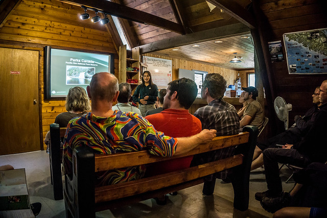
Finally, it was time for orientation. We got a primer/ slideshow from the Parks Canada ranger that included advice like “don’t eat the shellfish because of red tide;” that the Owen Point boulders to Thrasher Cove will be slow going, hiking poles not advised during this segment; how to read the Tide Tables thoughtfully pasted to our maps; and that the Thrasher Cove to Gordon River segment alone would take around 4.5 hours…
After 30 minutes, that was it, and we were set loose to start on the trail. We officially set off around 2:35pm. The map Parks Canada provided was excellent, and I kept my copy in my pocket the entire time for reference.
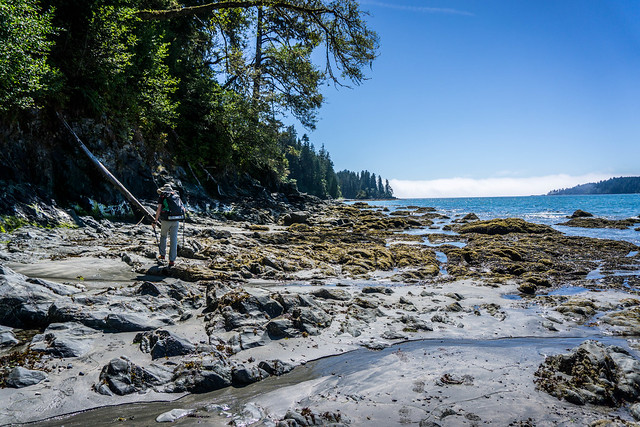
We started our hike on the beach, and managed to avoid what was purportedly the 2nd longest ladder on the trail.
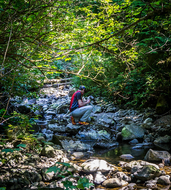
Barely 1 km into our hike, though, we had to stop and fill our Platypus hydration systems with some filtered water. The rest of our hike until Michigan Creek was inland, in forests with occasional glimpses of the coast.
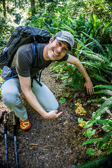
We made good time on this initial section, even pausing at some points to gleefully exclaim at the chanterelles DD discovered just along the trail!
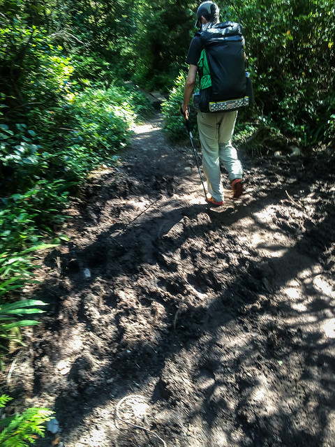
But even this first section, which now seemed easier in restrospect than subsequent segments, gave us a taste of what the inland trails were going to be like in the coming days. I remembered that one of the South-to-North women had muttered, “Mud… so much mud…”
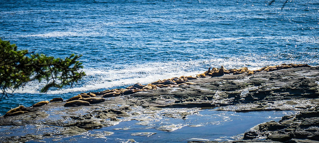
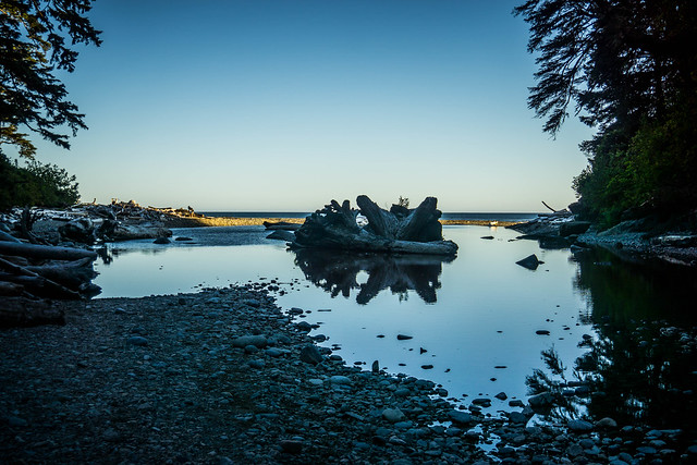
We had started out mid-afternoon, and felt like we had sped through the 8.7miles/ 14km fairly quickly to get to our campsite at Darling River, with a stop to filter water and side trips to look at a Sea Lion Haul Out Rock and the Pachena Point Lighthouse. DD was a little confused since he initially expected to be able access the beach from the Lighthouse area.
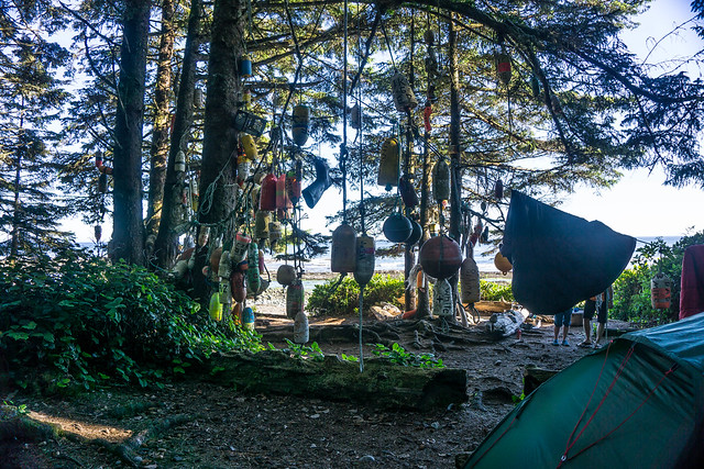
We finally made it to Michigan Creek camp, which was well-marked with hanging buoys and other floating devices. These were the prominent markers on our trip, signaling important landmarks to hikers, whether it was a camp or access back inland or egress to the coast.
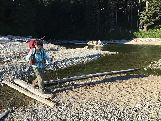
We then walked the final 2km from Michigan Creek Camp along the beach, sometimes encountering some water crossings.
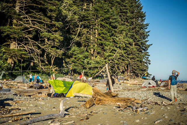
We eventually reached camp at around 7:15pm. While Kevin’s account in 2010 indicated that Michigan Creek Camp was crowded, and Darling River less so, the situation appeared to be reversed this time, and Darling River was the one that seemed more crowded. But we were not about to backtrack, and DD eventually found us a nice site that was more isolated from the rest of the campers there, but also furthest from the fresh water source.
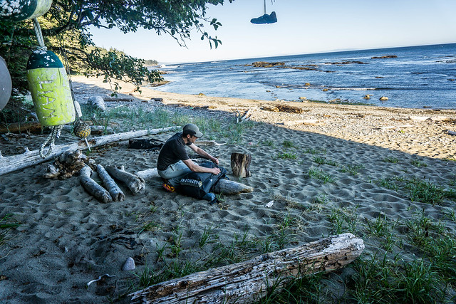
We set up our tent in the trees, and noticed a few mosquitoes flitting about in the sheltered spot. Thankfully they didn’t bother us too much, and I found that I had forgotten about them by the time I turned in for the evening.
As we ate our dinner of shepherd’s pie with cheesey potatoes, ground beef, mushrooms and other veggies, DD spotted what appeared to be several pods of Orcas swimming in the distance. He first noted sprays of water going up in the air, and, as we trained our eyes on the spot, began to observe glimpses of black and white here and there, even an Orca’s distinctive tail! We watched them for a while – seeing different pods in different areas, wishing that we could see them up close.
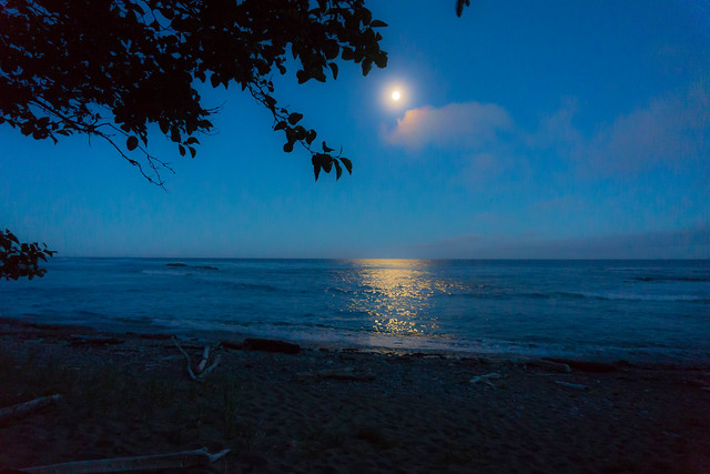
We had a full moon for the trip, which meant extra high tides and low tides. It was beautiful, and even more wonderful to fall asleep to the sounds of the sea crashing on the shore.
West Coast Trail Posts
- WCT Trip Planning
- WCT Day Zero + Flickr Photos
- WCT Day One + Flickr Photos
- WCT Day Two + Flickr Photos
- WCT Day Three + Flickr Photos
- WCT Day Four + Flickr Photos
- WCT Day Five + Flickr Photos
Pingback: West Coast Trail 2015 Day Zero | Legs, Engage!()
Pingback: West Coast Trail Trip Planning | Legs, Engage!()
Pingback: West Coast Trail Day Three | Legs, Engage!()
Pingback: West Coast Trail Day Four | Legs, Engage!()